Montelupo Fiorentino elevation
Montelupo Fiorentino (Tuscany, Province of Florence), Italy elevation is 39 meters and Montelupo Fiorentino elevation in feet is 128 ft above sea level [src 1]. Montelupo Fiorentino is a seat of a third-order administrative division (feature code) with elevation that is 283 meters (928 ft) smaller than average city elevation in Italy.
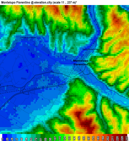
Below is the Elevation map of Montelupo Fiorentino, which displays elevation range with different colors. Scale of the first map is from 11 to 237 m (36 to 778 ft) with average elevation of 80.4 meters (=264 ft) [note 1]
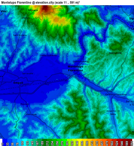
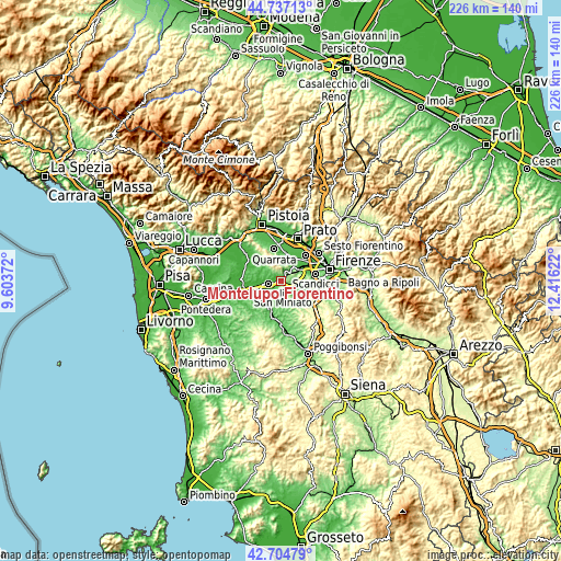
These maps also provides idea of topography and contour of this city, they are displayed at different zoom levels. More info about maps, scale and edge coordinates you can find below images.
| \ | Map #1 | Map #2 | Topo.Map |
| Scale [m] | 11..237 m | 11..591 m | × |
| Scale [ft] | 36..778 ft | 36..1939 ft | × |
| Average | 80.4 m = 264 ft | 110.8 m = 364 ft | × |
| Width | 7.06 km = 4.4 mi | 14.12 km = 8.8 mi | 226 km = 140.4 mi |
| Height | 7.06 km = 4.4 mi | 14.12 km = 8.8 mi | 226 km = 140.4 mi |
| ↑Max Latitude | 43.761327° | 43.793057° | 44.73713° |
| Latitude at center | 43.72958° | 43.72958° | 43.72958° |
| ↓Min Latitude | 43.697816° | 43.666036° | 42.70479° |
| ← Min Longitude | 10.966025° | 10.922079° | 9.60372° |
| Longitude center | 11.00997° | 11.00997° | 11.00997° |
| →Max Longitude | 11.053915° | 11.097861° | 12.41622° |
Nearby cities:
Cities around Montelupo Fiorentino sort by population:
• Empoli elevation 31 m
5.2 km,  255°
255°
• Lastra a Signa 37 m
9.4 km,  61°
61°
• Spicchio-Sovigliana 32 m
5.7 km,  270°
270°
• Capraia e Limite 28 m
2.8 km,  309°
309°
• Limite 28 m
2.9 km,  304°
304°
• Comeana 67 m
8.1 km,  28°
28°
• Carmignano 203 m
9 km,  2°
2°
• Pozzale-Case Nuove 35 m
5.7 km,  228°
228°
• Vinci 66 m
9 km, 309°
• Ginestra Fiorentina 72 m
5.6 km,  113°
113°
• Malmantile 199 m
5.4 km,  68°
68°
• Quattro Strade 154 m
5.8 km,  76°
76°
Multilingual:
 En español:
Montelupo Fiorentino elevación 39 m.
 En France:
Montelupo Fiorentino élévation 39 m.
 Auf Deutsch:
Montelupo Fiorentino höhe über dem Meeresspiegel ist 39 m.
 На русском:
Montelupo Fiorentino высота над уровнем моря 39 м
Sources and notes:
- [note 1] Map square and city borders are not equal. Map elevation data is calculated only from area inside that square.
- [src 1] Elevation data from geonames database provided with same terms of usage.
- [src 2] The elevation map of Montelupo Fiorentino is generated using elevation data from NASA's 3 arcsec (90m) resolution SRTM data.
- [src 3] Base (background) map © OpenStreetMap contributors tiles are generated by Geofabrik and OpenTopoMap.
Copyright & License:
This Montelupo Fiorentino Elevation Map is licensed under CC BY-SA. You may reuse any part from this page, if you give a proper credit by linking to this URL:
 More info on terms of use page.