Nardò elevation
Nardò (Apulia, Provincia di Lecce), Italy elevation is 47 meters and Nardò elevation in feet is 154 ft above sea level [src 1]. Nardò is a seat of a third-order administrative division (feature code) with elevation that is 275 meters (902 ft) smaller than average city elevation in Italy.
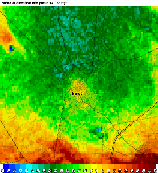
Below is the Elevation map of Nardò, which displays elevation range with different colors. Scale of the first map is from 18 to 63 m (59 to 207 ft) with average elevation of 40 meters (=131 ft) [note 1]
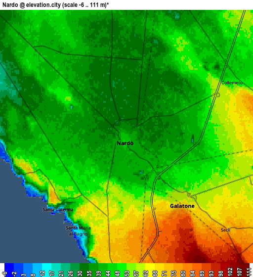
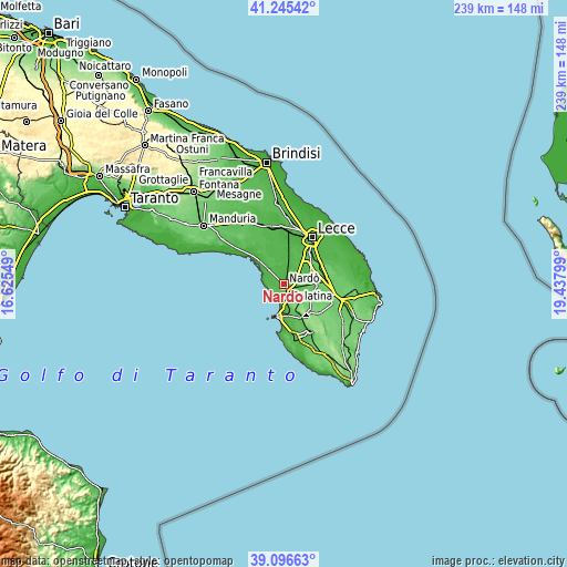
These maps also provides idea of topography and contour of this city, they are displayed at different zoom levels. More info about maps, scale and edge coordinates you can find below images.
| \ | Map #1 | Map #2 | Topo.Map |
| Scale [m] | 18..63 m | -6..111 m | × |
| Scale [ft] | 59..207 ft | -20..364 ft | × |
| Average | 40 m = 131 ft | 48.1 m = 158 ft | × |
| Width | 7.47 km = 4.6 mi | 14.93 km = 9.3 mi | 238.9 km = 148.4 mi |
| Height | 7.47 km = 4.6 mi | 14.93 km = 9.3 mi | 238.9 km = 148.4 mi |
| ↑Max Latitude | 40.213097° | 40.246648° | 41.24542° |
| Latitude at center | 40.17953° | 40.17953° | 40.17953° |
| ↓Min Latitude | 40.145946° | 40.112346° | 39.09663° |
| ← Min Longitude | 17.987795° | 17.943849° | 16.62549° |
| Longitude center | 18.03174° | 18.03174° | 18.03174° |
| →Max Longitude | 18.075685° | 18.119631° | 19.43799° |
Nearby cities:
Cities around Nardò sort by population:
• Copertino elevation 37 m
10 km,  10°
10°
• Galatina 83 m
11.8 km,  92°
92°
• Galatone 60 m
4.9 km,  138°
138°
• Leverano 37 m
12.5 km,  346°
346°
• Aradeo 78 m
10 km,  123°
123°
• Alezio 74 m
13.2 km,  170°
170°
• Neviano 113 m
10.8 km, 138°
• Tuglie 88 m
13.1 km,  154°
154°
• Sannicola 85 m
10.2 km,  162°
162°
• Noha 77 m
11.8 km,  104°
104°
• Collemeto 48 m
6.9 km,  61°
61°
• Seclì 97 m
9.4 km, 135°
Multilingual:
 En español:
Nardò elevación 47 m.
 En France:
Nardò élévation 47 m.
 Auf Deutsch:
Nardò, Nardo höhe über dem Meeresspiegel ist 47 m.

Sources and notes:
- [note 1] Map square and city borders are not equal. Map elevation data is calculated only from area inside that square.
- [src 1] Elevation data from geonames database provided with same terms of usage.
- [src 2] The elevation map of Nardò is generated using elevation data from NASA's 3 arcsec (90m) resolution SRTM data.
- [src 3] Base (background) map © OpenStreetMap contributors tiles are generated by Geofabrik and OpenTopoMap.
Copyright & License:
This Nardò Elevation Map is licensed under CC BY-SA. You may reuse any part from this page, if you give a proper credit by linking to this URL:
 More info on terms of use page.