Negrar elevation
Negrar (Veneto, Provincia di Verona), Italy elevation is 184 meters and Negrar elevation in feet is 604 ft above sea level [src 1]. Negrar is a seat of a third-order administrative division (feature code) with elevation that is 138 meters (453 ft) smaller than average city elevation in Italy.
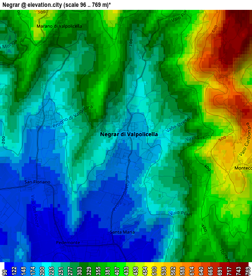
Below is the Elevation map of Negrar, which displays elevation range with different colors. Scale of the first map is from 96 to 769 m (315 to 2523 ft) with average elevation of 300.5 meters (=986 ft) [note 1]
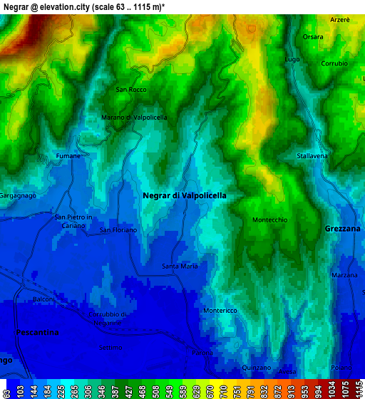
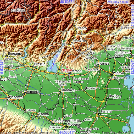
These maps also provides idea of topography and contour of this city, they are displayed at different zoom levels. More info about maps, scale and edge coordinates you can find below images.
| \ | Map #1 | Map #2 | Topo.Map |
| Scale [m] | 96..769 m | 63..1115 m | × |
| Scale [ft] | 315..2523 ft | 207..3658 ft | × |
| Average | 300.5 m = 986 ft | 326.4 m = 1071 ft | × |
| Width | 6.85 km = 4.3 mi | 13.69 km = 8.5 mi | 219.1 km = 136.1 mi |
| Height | 6.85 km = 4.3 mi | 13.69 km = 8.5 mi | 219.1 km = 136.1 mi |
| ↑Max Latitude | 45.559957° | 45.590718° | 46.5057° |
| Latitude at center | 45.52918° | 45.52918° | 45.52918° |
| ↓Min Latitude | 45.498386° | 45.467575° | 44.53541° |
| ← Min Longitude | 10.895045° | 10.851099° | 9.53274° |
| Longitude center | 10.93899° | 10.93899° | 10.93899° |
| →Max Longitude | 10.982935° | 11.026881° | 12.34524° |
Nearby cities:
Cities around Negrar sort by population:
• San Pietro in Cariano elevation 157 m
4.3 km,  252°
252°
• Arbizzano-Santa Maria 90 m
3.8 km,  180°
180°
• Pedemonte 112 m
3.3 km,  208°
208°
• Parona 71 m
5.6 km, 175°
• Stallavena-Lugo 279 m
5.9 km,  50°
50°
• Fumane 181 m
4.4 km,  288°
288°
• San Floriano 139 m
2.7 km,  242°
242°
• Corrubbio 109 m
5.5 km, 210°
• Settimo 83 m
6 km,  202°
202°
• Valgatara 185 m
2.2 km, 286°
• Fane 611 m
5.9 km,  19°
19°
• Marano di Valpolicella 361 m
3.5 km,  329°
329°
Multilingual:
 En español:
Negrar elevación 184 m.
 En France:
Negrar élévation 184 m.


Sources and notes:
- [note 1] Map square and city borders are not equal. Map elevation data is calculated only from area inside that square.
- [src 1] Elevation data from geonames database provided with same terms of usage.
- [src 2] The elevation map of Negrar is generated using elevation data from NASA's 3 arcsec (90m) resolution SRTM data.
- [src 3] Base (background) map © OpenStreetMap contributors tiles are generated by Geofabrik and OpenTopoMap.
Copyright & License:
This Negrar Elevation Map is licensed under CC BY-SA. You may reuse any part from this page, if you give a proper credit by linking to this URL:
 More info on terms of use page.