Nereto elevation
Nereto (Abruzzo, Provincia di Teramo), Italy elevation is 138 meters and Nereto elevation in feet is 453 ft above sea level [src 1]. Nereto is a seat of a third-order administrative division (feature code) with elevation that is 184 meters (604 ft) smaller than average city elevation in Italy.
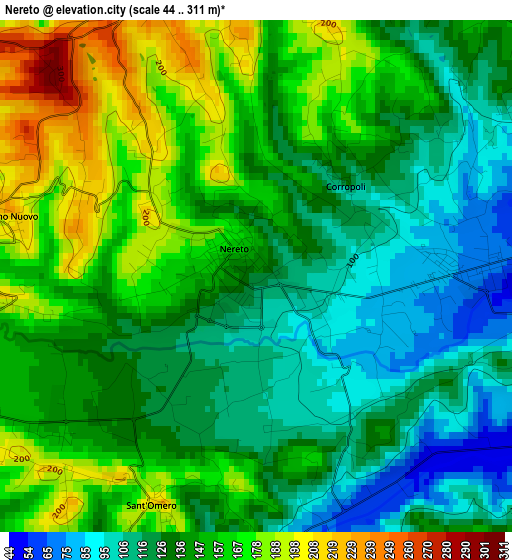
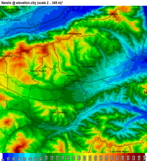
Below is the Elevation map of Nereto, which displays elevation range with different colors. Scale of the first map is from 44 to 311 m (144 to 1020 ft) with average elevation of 141.8 meters (=465 ft) [note 1]
These maps also provides idea of topography and contour of this city, they are displayed at different zoom levels. More info about maps, scale and edge coordinates you can find below images.
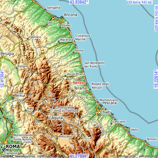
| \ | Map #1 | Map #2 | Topo.Map |
| Scale [m] | 44..311 m | 2..349 m | × |
| Scale [ft] | 144..1020 ft | 7..1145 ft | × |
| Average | 141.8 m = 465 ft | 134 m = 440 ft | × |
| Width | 7.17 km = 4.5 mi | 14.34 km = 8.9 mi | 229.4 km = 142.5 mi |
| Height | 7.17 km = 4.5 mi | 14.34 km = 8.9 mi | 229.4 km = 142.5 mi |
| ↑Max Latitude | 42.847708° | 42.879918° | 43.83842° |
| Latitude at center | 42.81548° | 42.81548° | 42.81548° |
| ↓Min Latitude | 42.783236° | 42.750975° | 41.77534° |
| ← Min Longitude | 13.775945° | 13.731999° | 12.41364° |
| Longitude center | 13.81989° | 13.81989° | 13.81989° |
| →Max Longitude | 13.863835° | 13.907781° | 15.22614° |
Nearby cities:
Cities around Nereto sort by population:
• Sant'Egidio alla Vibrata elevation 235 m
8 km,  271°
271°
• Pagliare 42 m
7.3 km,  325°
325°
• Stella 34 m
8 km,  353°
353°
• Corropoli 133 m
1.8 km,  42°
42°
• Sant'Omero 202 m
3.8 km,  221°
221°
• Colonnella 249 m
7.5 km,  32°
32°
• Salino 27 m
8.4 km,  113°
113°
• Controguerra 253 m
4.3 km,  357°
357°
• Bellante 342 m
8.1 km,  190°
190°
• Ancarano 252 m
6.5 km,  292°
292°
• Tortoreto 218 m
7.7 km,  99°
99°
• Torano Nuovo 233 m
3.6 km,  283°
283°
Multilingual:
 En español:
Nereto elevación 138 m.
 En France:
Nereto élévation 138 m.


Sources and notes:
- [note 1] Map square and city borders are not equal. Map elevation data is calculated only from area inside that square.
- [src 1] Elevation data from geonames database provided with same terms of usage.
- [src 2] The elevation map of Nereto is generated using elevation data from NASA's 3 arcsec (90m) resolution SRTM data.
- [src 3] Base (background) map © OpenStreetMap contributors tiles are generated by Geofabrik and OpenTopoMap.
Copyright & License:
This Nereto Elevation Map is licensed under CC BY-SA. You may reuse any part from this page, if you give a proper credit by linking to this URL:
 More info on terms of use page.