Olginate elevation
Olginate (Lombardy, Provincia di Lecco), Italy elevation is 202 meters and Olginate elevation in feet is 663 ft above sea level [src 1]. Olginate is a seat of a third-order administrative division (feature code) with elevation that is 120 meters (394 ft) smaller than average city elevation in Italy.
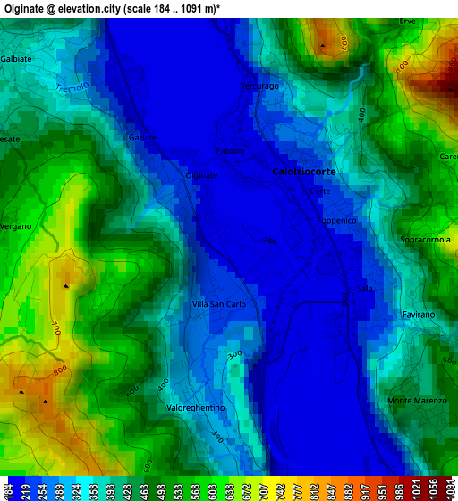
Below is the Elevation map of Olginate, which displays elevation range with different colors. Scale of the first map is from 184 to 1091 m (604 to 3579 ft) with average elevation of 403.7 meters (=1324 ft) [note 1]
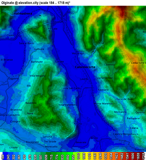
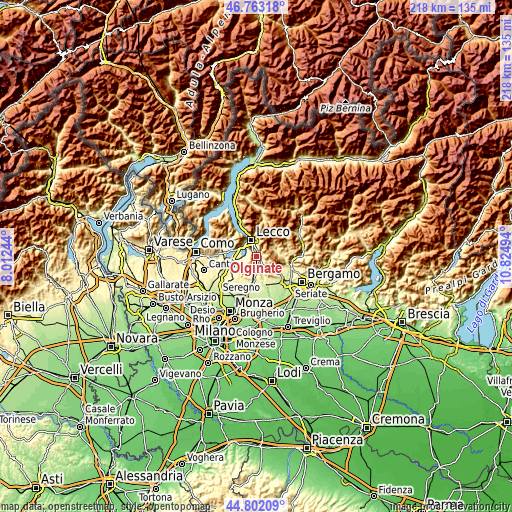
These maps also provides idea of topography and contour of this city, they are displayed at different zoom levels. More info about maps, scale and edge coordinates you can find below images.
| \ | Map #1 | Map #2 | Topo.Map |
| Scale [m] | 184..1091 m | 184..1718 m | × |
| Scale [ft] | 604..3579 ft | 604..5636 ft | × |
| Average | 403.7 m = 1324 ft | 488.7 m = 1603 ft | × |
| Width | 6.81 km = 4.2 mi | 13.63 km = 8.5 mi | 218.1 km = 135.5 mi |
| Height | 6.81 km = 4.2 mi | 13.63 km = 8.5 mi | 218 km = 135.5 mi |
| ↑Max Latitude | 45.821894° | 45.85251° | 46.76318° |
| Latitude at center | 45.79126° | 45.79126° | 45.79126° |
| ↓Min Latitude | 45.76061° | 45.729942° | 44.80209° |
| ← Min Longitude | 9.374745° | 9.330799° | 8.01244° |
| Longitude center | 9.41869° | 9.41869° | 9.41869° |
| →Max Longitude | 9.462635° | 9.506581° | 10.82494° |
Nearby cities:
Cities around Olginate sort by population:
• Calolziocorte elevation 225 m
1.5 km,  72°
72°
• Galbiate 362 m
4.2 km,  312°
312°
• Valgreghentino 257 m
1.4 km,  196°
196°
• Vercurago 222 m
2 km,  7°
7°
• Airuno 212 m
4.3 km,  170°
170°
• Garlate 204 m
2.7 km,  327°
327°
• Monte Marenzo 418 m
3.5 km,  127°
127°
• Carenno 647 m
3.6 km, 71°
• Vergano-Villa 526 m
3.4 km,  275°
275°
• Erve 575 m
4.3 km,  38°
38°
• Ello 405 m
4.2 km,  261°
261°
• Torre de' Busi 446 m
5.1 km,  111°
111°
Multilingual:
 En español:
Olginate elevación 202 m.
 En France:
Olginate élévation 202 m.
 Auf Deutsch:
Olginate höhe über dem Meeresspiegel ist 202 m.

Sources and notes:
- [note 1] Map square and city borders are not equal. Map elevation data is calculated only from area inside that square.
- [src 1] Elevation data from geonames database provided with same terms of usage.
- [src 2] The elevation map of Olginate is generated using elevation data from NASA's 3 arcsec (90m) resolution SRTM data.
- [src 3] Base (background) map © OpenStreetMap contributors tiles are generated by Geofabrik and OpenTopoMap.
Copyright & License:
This Olginate Elevation Map is licensed under CC BY-SA. You may reuse any part from this page, if you give a proper credit by linking to this URL:
 More info on terms of use page.