Ozzero elevation
Ozzero (Lombardy, Città metropolitana di Milano), Italy elevation is 107 meters and Ozzero elevation in feet is 351 ft above sea level [src 1]. Ozzero is a seat of a third-order administrative division (feature code) with elevation that is 215 meters (705 ft) smaller than average city elevation in Italy.
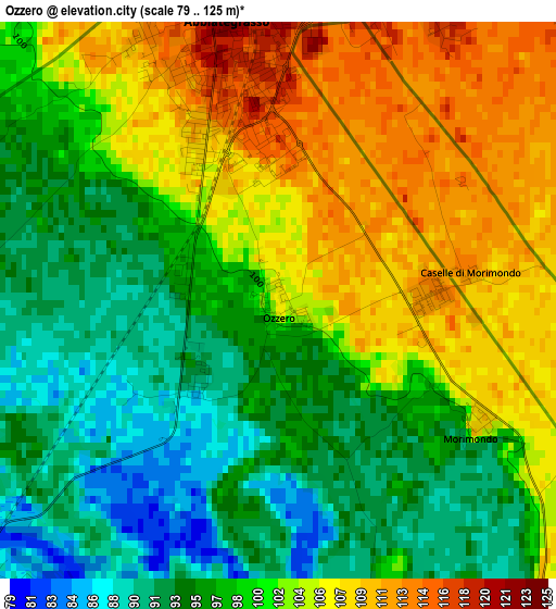
Below is the Elevation map of Ozzero, which displays elevation range with different colors. Scale of the first map is from 79 to 125 m (259 to 410 ft) with average elevation of 100.3 meters (=329 ft) [note 1]
These maps also provides idea of topography and contour of this city, they are displayed at different zoom levels. More info about maps, scale and edge coordinates you can find below images.
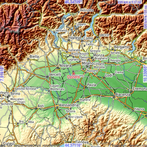
| \ | Map #1 | Topo.Map |
| Scale [m] | 79..125 m | × |
| Scale [ft] | 259..410 ft | × |
| Average | 100.3 m = 329 ft | × |
| Width | 6.87 km = 4.3 mi | 219.7 km = 136.5 mi |
| Height | 6.87 km = 4.3 mi | 219.7 km = 136.5 mi |
| ↑Max Latitude | 45.398616° | 46.34709° |
| Latitude at center | 45.36775° | 45.36775° |
| ↓Min Latitude | 45.336868° | 44.37116° |
| ← Min Longitude | 8.880455° | 7.51815° |
| Longitude center | 8.9244° | 8.9244° |
| →Max Longitude | 8.968345° | 10.33065° |
Nearby cities:
Cities around Ozzero sort by population:
• Vigevano elevation 112 m
8.1 km,  222°
222°
• Abbiategrasso 126 m
3.4 km,  350°
350°
• Rosate 107 m
7.5 km,  105°
105°
• Robecco sul Naviglio 128 m
8.2 km,  338°
338°
• Albairate 122 m
5.9 km,  10°
10°
• Vermezzo 115 m
5.3 km,  53°
53°
• Bubbiano 105 m
8.4 km,  122°
122°
• Besate 101 m
7 km,  149°
149°
• Cassinetta di Lugagnano 124 m
6.3 km, 346°
• Gudo Visconti 111 m
6 km,  83°
83°
• Zelo Surrigone 114 m
5.2 km,  64°
64°
• Morimondo 110 m
2.9 km, 121°
Multilingual:
 En español:
Ozzero elevación 107 m.
 En France:
Ozzero élévation 107 m.


Sources and notes:
- [note 1] Map square and city borders are not equal. Map elevation data is calculated only from area inside that square.
- [src 1] Elevation data from geonames database provided with same terms of usage.
- [src 2] The elevation map of Ozzero is generated using elevation data from NASA's 3 arcsec (90m) resolution SRTM data.
- [src 3] Base (background) map © OpenStreetMap contributors tiles are generated by Geofabrik and OpenTopoMap.
Copyright & License:
This Ozzero Elevation Map is licensed under CC BY-SA. You may reuse any part from this page, if you give a proper credit by linking to this URL:
 More info on terms of use page.