Paganica-Tempera elevation
Paganica-Tempera (Abruzzo, Provincia dell' Aquila), Italy elevation is 655 meters and Paganica-Tempera elevation in feet is 2149 ft above sea level [src 1]. Paganica-Tempera is a populated place (feature code) with elevation that is 333 meters (1093 ft) bigger than average city elevation in Italy.
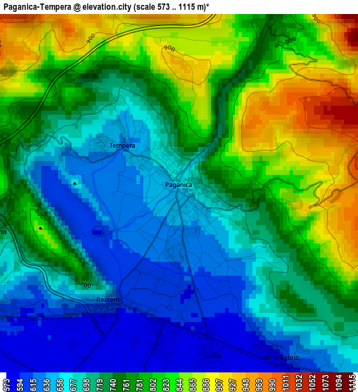
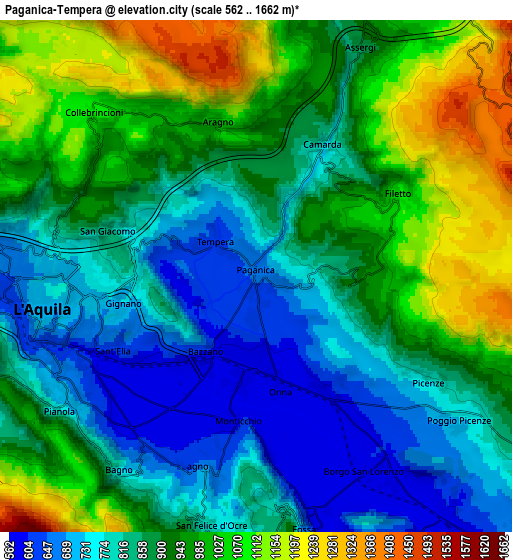
Below is the Elevation map of Paganica-Tempera, which displays elevation range with different colors. Scale of the first map is from 573 to 1115 m (1880 to 3658 ft) with average elevation of 742 meters (=2434 ft) [note 1]
These maps also provides idea of topography and contour of this city, they are displayed at different zoom levels. More info about maps, scale and edge coordinates you can find below images.
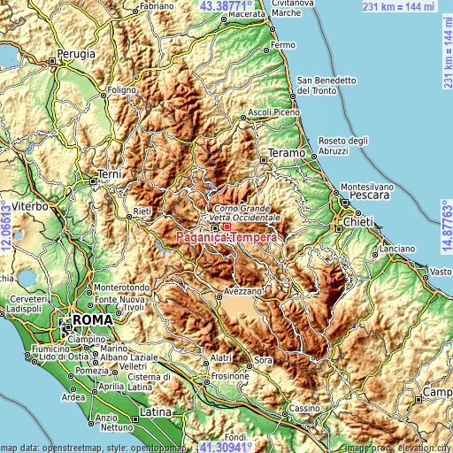
| \ | Map #1 | Map #2 | Topo.Map |
| Scale [m] | 573..1115 m | 562..1662 m | × |
| Scale [ft] | 1880..3658 ft | 1844..5453 ft | × |
| Average | 742 m = 2434 ft | 899.4 m = 2951 ft | × |
| Width | 7.22 km = 4.5 mi | 14.44 km = 9 mi | 231.1 km = 143.6 mi |
| Height | 7.22 km = 4.5 mi | 14.44 km = 9 mi | 231.1 km = 143.6 mi |
| ↑Max Latitude | 42.389615° | 42.422064° | 43.38771° |
| Latitude at center | 42.35715° | 42.35715° | 42.35715° |
| ↓Min Latitude | 42.324668° | 42.292169° | 41.30941° |
| ← Min Longitude | 13.427435° | 13.383489° | 12.06513° |
| Longitude center | 13.47138° | 13.47138° | 13.47138° |
| →Max Longitude | 13.515325° | 13.559271° | 14.87763° |
Nearby cities:
Cities around Paganica-Tempera sort by population:
• L'Aquila elevation 728 m
5.9 km,  262°
262°
• Nucleo Industriale di Bazzano 594 m
2.3 km,  187°
187°
• San Demetrio Ne' Vestini 643 m
10.2 km,  137°
137°
• Progetto Case Bazzano 615 m
3.2 km,  224°
224°
• Barisciano 935 m
10.4 km,  110°
110°
• Monticchio 589 m
4.1 km, 188°
• Pianola 743 m
6.7 km,  235°
235°
• Poggio Picenze 737 m
7 km,  125°
125°
• Cominio 631 m
5.9 km,  212°
212°
• Fossa 661 m
7.3 km,  169°
169°
• San Panfilo d'Ocre 844 m
7.9 km,  177°
177°
• Sant'Eusanio Forconese 590 m
8.7 km,  149°
149°
Multilingual:
 En español:
Paganica-Tempera elevación 655 m.
 En France:
Paganica-Tempera élévation 655 m.
 Auf Deutsch:
Paganica-Tempera höhe über dem Meeresspiegel ist 655 m.

Sources and notes:
- [note 1] Map square and city borders are not equal. Map elevation data is calculated only from area inside that square.
- [src 1] Elevation data from geonames database provided with same terms of usage.
- [src 2] The elevation map of Paganica-Tempera is generated using elevation data from NASA's 3 arcsec (90m) resolution SRTM data.
- [src 3] Base (background) map © OpenStreetMap contributors tiles are generated by Geofabrik and OpenTopoMap.
Copyright & License:
This Paganica-Tempera Elevation Map is licensed under CC BY-SA. You may reuse any part from this page, if you give a proper credit by linking to this URL:
 More info on terms of use page.