Pandino elevation
Pandino (Lombardy, Provincia di Cremona), Italy elevation is 88 meters and Pandino elevation in feet is 289 ft above sea level [src 1]. Pandino is a seat of a third-order administrative division (feature code) with elevation that is 234 meters (768 ft) smaller than average city elevation in Italy.
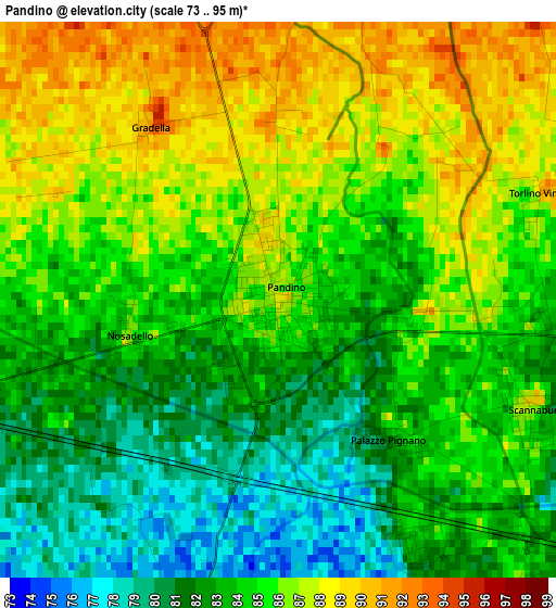
Below is the Elevation map of Pandino, which displays elevation range with different colors. Scale of the first map is from 73 to 95 m (240 to 312 ft) with average elevation of 84.4 meters (=277 ft) [note 1]
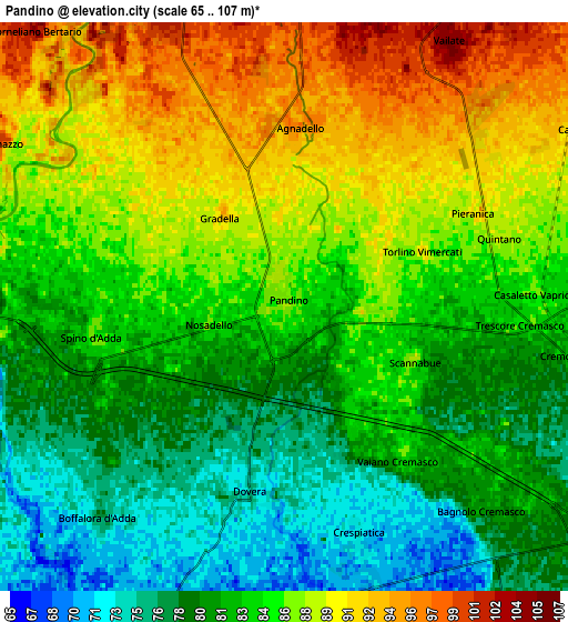
These maps also provides idea of topography and contour of this city, they are displayed at different zoom levels. More info about maps, scale and edge coordinates you can find below images.
| \ | Map #1 | Map #2 | Topo.Map |
| Scale [m] | 73..95 m | 65..107 m | × |
| Scale [ft] | 240..312 ft | 213..351 ft | × |
| Average | 84.4 m = 277 ft | 84.2 m = 276 ft | × |
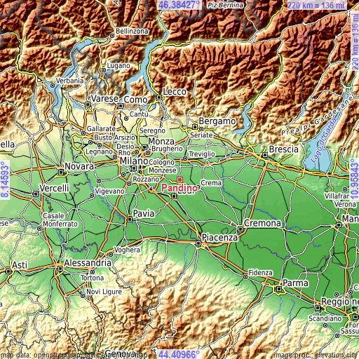
| Width | 6.86 km = 4.3 mi | 13.72 km = 8.5 mi | 219.6 km = 136.5 mi |
| Height | 6.86 km = 4.3 mi | 13.72 km = 8.5 mi | 219.5 km = 136.4 mi |
| ↑Max Latitude | 45.436435° | 45.467263° | 46.38427° |
| Latitude at center | 45.40559° | 45.40559° | 45.40559° |
| ↓Min Latitude | 45.374728° | 45.34385° | 44.40966° |
| ← Min Longitude | 9.508235° | 9.464289° | 8.14593° |
| Longitude center | 9.55218° | 9.55218° | 9.55218° |
| →Max Longitude | 9.596125° | 9.640071° | 10.95843° |
Nearby cities:
Cities around Pandino sort by population:
• Spino d'Adda elevation 84 m
5.1 km,  264°
264°
• Vaiano Cremasco 84 m
4.7 km,  143°
143°
• Dovera 73 m
4.6 km,  187°
187°
• Agnadello 97 m
4.4 km,  1°
1°
• Trescore Cremasco 82 m
5.5 km,  93°
93°
• Scannabue-Cascine Capri 85 m
3.5 km,  113°
113°
• Monte Cremasco 79 m
4 km,  156°
156°
• Palazzo Pignano 81 m
2.2 km, 141°
• Nosadello 84 m
1.7 km, 259°
• Pieranica 90 m
5.1 km,  63°
63°
• Quintano 88 m
5.4 km,  72°
72°
• Torlino Vimercati 89 m
3.6 km, 68°
Multilingual:
 En español:
Pandino elevación 88 m.
 En France:
Pandino élévation 88 m.


Sources and notes:
- [note 1] Map square and city borders are not equal. Map elevation data is calculated only from area inside that square.
- [src 1] Elevation data from geonames database provided with same terms of usage.
- [src 2] The elevation map of Pandino is generated using elevation data from NASA's 3 arcsec (90m) resolution SRTM data.
- [src 3] Base (background) map © OpenStreetMap contributors tiles are generated by Geofabrik and OpenTopoMap.
Copyright & License:
This Pandino Elevation Map is licensed under CC BY-SA. You may reuse any part from this page, if you give a proper credit by linking to this URL:
 More info on terms of use page.