Parma elevation
Parma (Emilia-Romagna, Provincia di Parma), Italy elevation is 64 meters and Parma elevation in feet is 210 ft above sea level [src 1]. Parma is a seat of a second-order administrative division (feature code) with elevation that is 258 meters (846 ft) smaller than average city elevation in Italy.
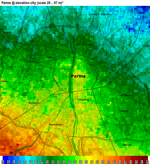
Below is the Elevation map of Parma, which displays elevation range with different colors. Scale of the first map is from 29 to 97 m (95 to 318 ft) with average elevation of 57 meters (=187 ft) [note 1]
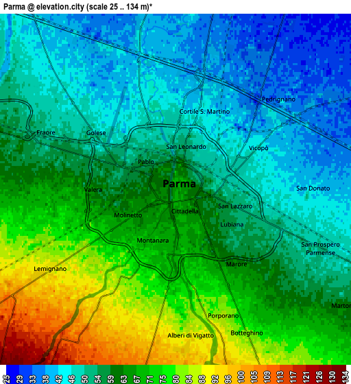
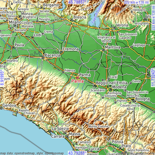
These maps also provides idea of topography and contour of this city, they are displayed at different zoom levels. More info about maps, scale and edge coordinates you can find below images.
| \ | Map #1 | Map #2 | Topo.Map |
| Scale [m] | 29..97 m | 25..134 m | × |
| Scale [ft] | 95..318 ft | 82..440 ft | × |
| Average | 57 m = 187 ft | 59.6 m = 196 ft | × |
| Width | 6.93 km = 4.3 mi | 13.87 km = 8.6 mi | 221.9 km = 137.9 mi |
| Height | 6.93 km = 4.3 mi | 13.87 km = 8.6 mi | 221.9 km = 137.9 mi |
| ↑Max Latitude | 44.830524° | 44.861682° | 45.78857° |
| Latitude at center | 44.79935° | 44.79935° | 44.79935° |
| ↓Min Latitude | 44.768159° | 44.736951° | 43.79288° |
| ← Min Longitude | 10.282235° | 10.238289° | 8.91993° |
| Longitude center | 10.32618° | 10.32618° | 10.32618° |
| →Max Longitude | 10.370125° | 10.414071° | 11.73243° |
Nearby cities:
Cities around Parma sort by population:
• Collecchio elevation 116 m
10.2 km,  238°
238°
• Sorbolo 35 m
10.6 km,  60°
60°
• Monticelli Terme 95 m
9.5 km,  145°
145°
• San Polo 31 m
10.3 km,  13°
13°
• Corcagnano 124 m
8.9 km,  192°
192°
• Ponte Taro 61 m
9.7 km,  289°
289°
• Baganzola 42 m
6.4 km,  346°
346°
• Vicofertile 79 m
5.3 km,  253°
253°
• Vigatto 118 m
8.8 km,  177°
177°
• Alberi 85 m
5.7 km, 176°
• Porporano 82 m
5.5 km,  159°
159°
• San Prospero 52 m
6.4 km,  113°
113°
Multilingual:
 En español:
Parma elevación 64 m.
 En France:
Parme élévation 64 m.


Sources and notes:
- [note 1] Map square and city borders are not equal. Map elevation data is calculated only from area inside that square.
- [src 1] Elevation data from geonames database provided with same terms of usage.
- [src 2] The elevation map of Parma is generated using elevation data from NASA's 3 arcsec (90m) resolution SRTM data.
- [src 3] Base (background) map © OpenStreetMap contributors tiles are generated by Geofabrik and OpenTopoMap.
Copyright & License:
This Parma Elevation Map is licensed under CC BY-SA. You may reuse any part from this page, if you give a proper credit by linking to this URL:
 More info on terms of use page.