Parolise elevation
Parolise (Campania, Provincia di Avellino), Italy elevation is 547 meters and Parolise elevation in feet is 1795 ft above sea level [src 1]. Parolise is a seat of a third-order administrative division (feature code) with elevation that is 225 meters (738 ft) bigger than average city elevation in Italy.
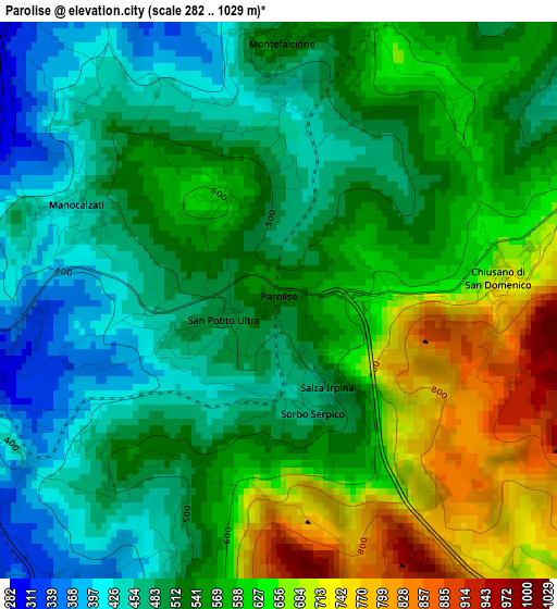
Below is the Elevation map of Parolise, which displays elevation range with different colors. Scale of the first map is from 282 to 1029 m (925 to 3376 ft) with average elevation of 554.3 meters (=1819 ft) [note 1]
These maps also provides idea of topography and contour of this city, they are displayed at different zoom levels. More info about maps, scale and edge coordinates you can find below images.
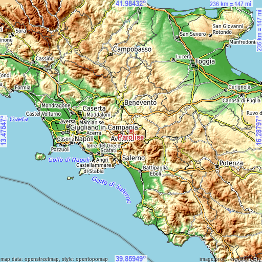
| \ | Map #1 | Topo.Map |
| Scale [m] | 282..1029 m | × |
| Scale [ft] | 925..3376 ft | × |
| Average | 554.3 m = 1819 ft | × |
| Width | 7.38 km = 4.6 mi | 236.3 km = 146.8 mi |
| Height | 7.38 km = 4.6 mi | 236.3 km = 146.8 mi |
| ↑Max Latitude | 40.963643° | 41.98432° |
| Latitude at center | 40.93045° | 40.93045° |
| ↓Min Latitude | 40.897241° | 39.85949° |
| ← Min Longitude | 14.837775° | 13.47547° |
| Longitude center | 14.88172° | 14.88172° |
| →Max Longitude | 14.925665° | 16.28797° |
Nearby cities:
Cities around Parolise sort by population:
• Atripalda elevation 307 m
4.8 km,  254°
254°
• Volturara Irpina 681 m
6.1 km,  150°
150°
• Montefalcione 541 m
3.5 km,  1°
1°
• Cesinali 369 m
5.9 km,  230°
230°
• Chiusano di San Domenico 704 m
2.9 km,  84°
84°
• San Michele di Serino 355 m
6.5 km,  200°
200°
• Manocalzati 439 m
3.1 km,  293°
293°
• San Potito Ultra 500 m
0.9 km, 252°
• Candida 601 m
1.5 km,  327°
327°
• Salza Irpina 507 m
1.5 km, 151°
• Santo Stefano del Sole 485 m
4.2 km, 197°
• Sorbo Serpico 486 m
1.6 km,  163°
163°
Multilingual:
 En español:
Parolise elevación 547 m.
 En France:
Parolise élévation 547 m.
 Auf Deutsch:
Parolise höhe über dem Meeresspiegel ist 547 m.

Sources and notes:
- [note 1] Map square and city borders are not equal. Map elevation data is calculated only from area inside that square.
- [src 1] Elevation data from geonames database provided with same terms of usage.
- [src 2] The elevation map of Parolise is generated using elevation data from NASA's 3 arcsec (90m) resolution SRTM data.
- [src 3] Base (background) map © OpenStreetMap contributors tiles are generated by Geofabrik and OpenTopoMap.
Copyright & License:
This Parolise Elevation Map is licensed under CC BY-SA. You may reuse any part from this page, if you give a proper credit by linking to this URL:
 More info on terms of use page.