Pegognaga elevation
Pegognaga (Lombardy, Provincia di Mantova), Italy elevation is 17 meters and Pegognaga elevation in feet is 56 ft above sea level [src 1]. Pegognaga is a seat of a third-order administrative division (feature code) with elevation that is 305 meters (1001 ft) smaller than average city elevation in Italy.
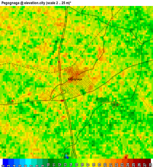
Below is the Elevation map of Pegognaga, which displays elevation range with different colors. Scale of the first map is from 2 to 25 m (7 to 82 ft) with average elevation of 15.6 meters (=51 ft) [note 1]
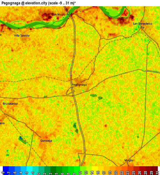
These maps also provides idea of topography and contour of this city, they are displayed at different zoom levels. More info about maps, scale and edge coordinates you can find below images.
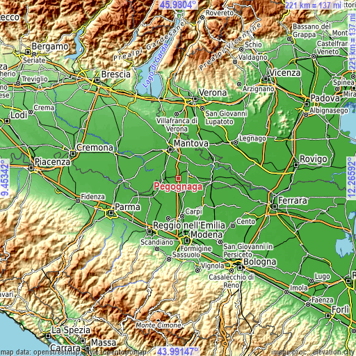
| \ | Map #1 | Map #2 | Topo.Map |
| Scale [m] | 2..25 m | -9..31 m | × |
| Scale [ft] | 7..82 ft | -30..102 ft | × |
| Average | 15.6 m = 51 ft | 15.9 m = 52 ft | × |
| Width | 6.91 km = 4.3 mi | 13.82 km = 8.6 mi | 221.1 km = 137.4 mi |
| Height | 6.91 km = 4.3 mi | 13.82 km = 8.6 mi | 221.1 km = 137.4 mi |
| ↑Max Latitude | 45.025629° | 45.05668° | 45.9804° |
| Latitude at center | 44.99456° | 44.99456° | 44.99456° |
| ↓Min Latitude | 44.963475° | 44.932372° | 43.99147° |
| ← Min Longitude | 10.815725° | 10.771779° | 9.45342° |
| Longitude center | 10.85967° | 10.85967° | 10.85967° |
| →Max Longitude | 10.903615° | 10.947561° | 12.26592° |
Nearby cities:
Cities around Pegognaga sort by population:
• Suzzara elevation 20 m
9.1 km,  268°
268°
• Reggiolo 21 m
9.3 km,  204°
204°
• San Benedetto Po 16 m
8.2 km,  45°
45°
• Gonzaga 19 m
5.7 km,  213°
213°
• Moglia 16 m
7.9 km,  146°
146°
• Quistello 18 m
9.9 km,  81°
81°
• Bagnolo San Vito 19 m
10.6 km,  7°
7°
• Codisotto 21 m
10.5 km,  262°
262°
• Bondeno 17 m
6.5 km,  179°
179°
• Borgoforte 22 m
10.7 km,  306°
306°
• Palidano 20 m
6.8 km,  248°
248°
• Motteggiana 18 m
8.7 km,  299°
299°
Multilingual:
 En español:
Pegognaga elevación 17 m.
 En France:
Pegognaga élévation 17 m.
 Auf Deutsch:
Pegognaga höhe über dem Meeresspiegel ist 17 m.

Sources and notes:
- [note 1] Map square and city borders are not equal. Map elevation data is calculated only from area inside that square.
- [src 1] Elevation data from geonames database provided with same terms of usage.
- [src 2] The elevation map of Pegognaga is generated using elevation data from NASA's 3 arcsec (90m) resolution SRTM data.
- [src 3] Base (background) map © OpenStreetMap contributors tiles are generated by Geofabrik and OpenTopoMap.
Copyright & License:
This Pegognaga Elevation Map is licensed under CC BY-SA. You may reuse any part from this page, if you give a proper credit by linking to this URL:
 More info on terms of use page.