Pigra elevation
Pigra (Lombardy, Provincia di Como), Italy elevation is 913 meters and Pigra elevation in feet is 2995 ft above sea level [src 1]. Pigra is a seat of a third-order administrative division (feature code) with elevation that is 591 meters (1939 ft) bigger than average city elevation in Italy.
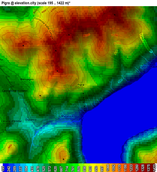
Below is the Elevation map of Pigra, which displays elevation range with different colors. Scale of the first map is from 195 to 1422 m (640 to 4665 ft) with average elevation of 708.7 meters (=2325 ft) [note 1]
These maps also provides idea of topography and contour of this city, they are displayed at different zoom levels. More info about maps, scale and edge coordinates you can find below images.
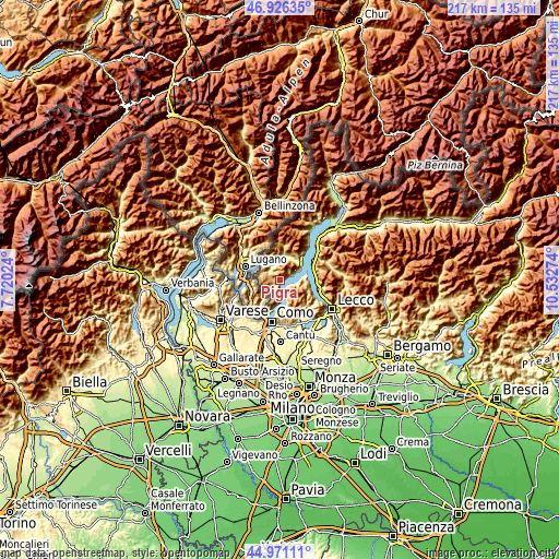
| \ | Map #1 | Topo.Map |
| Scale [m] | 195..1422 m | × |
| Scale [ft] | 640..4665 ft | × |
| Average | 708.7 m = 2325 ft | × |
| Width | 6.79 km = 4.2 mi | 217.4 km = 135.1 mi |
| Height | 6.79 km = 4.2 mi | 217.4 km = 135.1 mi |
| ↑Max Latitude | 45.987892° | 46.92635° |
| Latitude at center | 45.95735° | 45.95735° |
| ↓Min Latitude | 45.926791° | 44.97111° |
| ← Min Longitude | 9.082545° | 7.72024° |
| Longitude center | 9.12649° | 9.12649° |
| →Max Longitude | 9.170435° | 10.53274° |
Nearby cities:
Cities around Pigra sort by population:
• San Fedele Intelvi elevation 762 m
3.7 km,  287°
287°
• Ossuccio 238 m
4.3 km,  71°
71°
• Schignano 572 m
3.6 km,  211°
211°
• Castiglione d'Intelvi 618 m
2.8 km,  270°
270°
• Occagno 558 m
3.8 km, 214°
• Sala Comacina 233 m
3.1 km,  76°
76°
• Argegno 247 m
1.7 km,  180°
180°
• Colonno 244 m
2 km,  88°
88°
• Casasco Intelvi 839 m
4.2 km,  248°
248°
• Cerano d'Intelvi 563 m
3.3 km,  244°
244°
• Dizzasco-Biazzeno 508 m
2.6 km,  233°
233°
• Blessagno 779 m
2.2 km, 274°
Multilingual:
 En español:
Pigra elevación 913 m.
 En France:
Pigra élévation 913 m.


Sources and notes:
- [note 1] Map square and city borders are not equal. Map elevation data is calculated only from area inside that square.
- [src 1] Elevation data from geonames database provided with same terms of usage.
- [src 2] The elevation map of Pigra is generated using elevation data from NASA's 3 arcsec (90m) resolution SRTM data.
- [src 3] Base (background) map © OpenStreetMap contributors tiles are generated by Geofabrik and OpenTopoMap.
Copyright & License:
This Pigra Elevation Map is licensed under CC BY-SA. You may reuse any part from this page, if you give a proper credit by linking to this URL:
 More info on terms of use page.