Puglianello elevation
Puglianello (Campania, Provincia di Benevento), Italy elevation is 55 meters and Puglianello elevation in feet is 180 ft above sea level [src 1]. Puglianello is a seat of a third-order administrative division (feature code) with elevation that is 267 meters (876 ft) smaller than average city elevation in Italy.
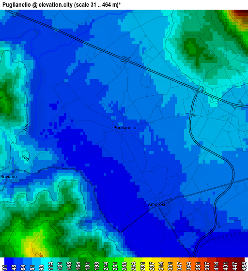
Below is the Elevation map of Puglianello, which displays elevation range with different colors. Scale of the first map is from 31 to 464 m (102 to 1522 ft) with average elevation of 86.8 meters (=285 ft) [note 1]
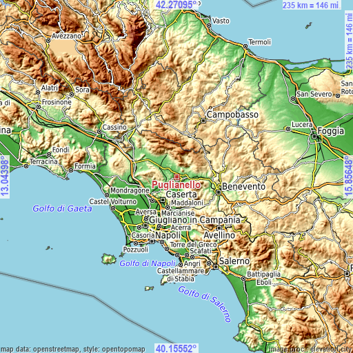
These maps also provides idea of topography and contour of this city, they are displayed at different zoom levels. More info about maps, scale and edge coordinates you can find below images.
| \ | Map #1 | Topo.Map |
| Scale [m] | 31..464 m | × |
| Scale [ft] | 102..1522 ft | × |
| Average | 86.8 m = 285 ft | × |
| Width | 7.35 km = 4.6 mi | 235.2 km = 146.1 mi |
| Height | 7.35 km = 4.6 mi | 235.2 km = 146.1 mi |
| ↑Max Latitude | 41.254836° | 42.27095° |
| Latitude at center | 41.22179° | 41.22179° |
| ↓Min Latitude | 41.188728° | 40.15552° |
| ← Min Longitude | 14.406285° | 13.04398° |
| Longitude center | 14.45023° | 14.45023° |
| →Max Longitude | 14.494175° | 15.85648° |
Nearby cities:
Cities around Puglianello sort by population:
• Telese elevation 57 m
6.4 km,  94°
94°
• Solopaca 151 m
8.7 km,  109°
109°
• Caiazzo 144 m
8.7 km,  241°
241°
• Amorosi 56 m
2.5 km,  148°
148°
• San Salvatore Telesino 89 m
4.3 km,  69°
69°
• Castelvenere 122 m
8.3 km,  80°
80°
• Melizzano 177 m
8.1 km, 145°
• Gioia Sannitica 251 m
8.7 km,  356°
356°
• San Lorenzello 213 m
9.7 km,  51°
51°
• Faicchio 180 m
6.7 km,  19°
19°
• Castel Campagnano 45 m
4.4 km,  176°
176°
• Ruviano 70 m
3.6 km,  249°
249°
Multilingual:
 En español:
Puglianello elevación 55 m.
 En France:
Puglianello élévation 55 m.
 Auf Deutsch:
Puglianello höhe über dem Meeresspiegel ist 55 m.

Sources and notes:
- [note 1] Map square and city borders are not equal. Map elevation data is calculated only from area inside that square.
- [src 1] Elevation data from geonames database provided with same terms of usage.
- [src 2] The elevation map of Puglianello is generated using elevation data from NASA's 3 arcsec (90m) resolution SRTM data.
- [src 3] Base (background) map © OpenStreetMap contributors tiles are generated by Geofabrik and OpenTopoMap.
Copyright & License:
This Puglianello Elevation Map is licensed under CC BY-SA. You may reuse any part from this page, if you give a proper credit by linking to this URL:
 More info on terms of use page.