Quagliuzzo elevation
Quagliuzzo (Piedmont, Torino), Italy elevation is 350 meters and Quagliuzzo elevation in feet is 1148 ft above sea level [src 1]. Quagliuzzo is a seat of a third-order administrative division (feature code) with elevation that is 28 meters (92 ft) bigger than average city elevation in Italy.
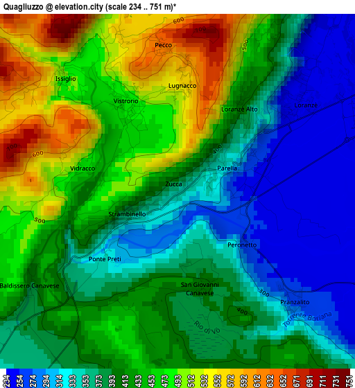
Below is the Elevation map of Quagliuzzo, which displays elevation range with different colors. Scale of the first map is from 234 to 751 m (768 to 2464 ft) with average elevation of 410.6 meters (=1347 ft) [note 1]
These maps also provides idea of topography and contour of this city, they are displayed at different zoom levels. More info about maps, scale and edge coordinates you can find below images.
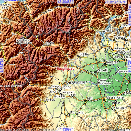
| \ | Map #1 | Topo.Map |
| Scale [m] | 234..751 m | × |
| Scale [ft] | 768..2464 ft | × |
| Average | 410.6 m = 1347 ft | × |
| Width | 6.86 km = 4.3 mi | 219.5 km = 136.4 mi |
| Height | 6.86 km = 4.3 mi | 219.5 km = 136.4 mi |
| ↑Max Latitude | 45.457373° | 46.40485° |
| Latitude at center | 45.42654° | 45.42654° |
| ↓Min Latitude | 45.39569° | 44.43097° |
| ← Min Longitude | 7.737065° | 6.37476° |
| Longitude center | 7.78101° | 7.78101° |
| →Max Longitude | 7.824955° | 9.18726° |
Nearby cities:
Cities around Quagliuzzo sort by population:
• Loranzè elevation 244 m
3.1 km,  54°
54°
• Colleretto Giacosa 263 m
1.5 km,  62°
62°
• Torre Canavese 389 m
4.2 km,  203°
203°
• Vistrorio 478 m
2 km,  328°
328°
• Parella 320 m
0.9 km, 63°
• Alice Superiore 624 m
3.8 km,  357°
357°
• Issiglio 492 m
3.1 km,  315°
315°
• Vidracco 481 m
1.9 km,  283°
283°
• Lugnacco 567 m
2.1 km,  2°
2°
• Strambinello 382 m
0.9 km,  245°
245°
• Pecco 634 m
2.9 km,  354°
354°
• Baldissero Canavese 391 m
3.4 km,  237°
237°
Multilingual:
 En español:
Quagliuzzo elevación 350 m.
 En France:
Quagliuzzo élévation 350 m.
 Auf Deutsch:
Quagliuzzo höhe über dem Meeresspiegel ist 350 m.

Sources and notes:
- [note 1] Map square and city borders are not equal. Map elevation data is calculated only from area inside that square.
- [src 1] Elevation data from geonames database provided with same terms of usage.
- [src 2] The elevation map of Quagliuzzo is generated using elevation data from NASA's 3 arcsec (90m) resolution SRTM data.
- [src 3] Base (background) map © OpenStreetMap contributors tiles are generated by Geofabrik and OpenTopoMap.
Copyright & License:
This Quagliuzzo Elevation Map is licensed under CC BY-SA. You may reuse any part from this page, if you give a proper credit by linking to this URL:
 More info on terms of use page.