Rapone elevation
Rapone (Basilicate, Provincia di Potenza), Italy elevation is 811 meters and Rapone elevation in feet is 2661 ft above sea level [src 1]. Rapone is a seat of a third-order administrative division (feature code) with elevation that is 489 meters (1604 ft) bigger than average city elevation in Italy.
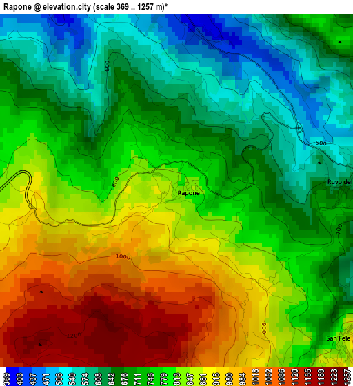
Below is the Elevation map of Rapone, which displays elevation range with different colors. Scale of the first map is from 369 to 1257 m (1211 to 4124 ft) with average elevation of 782.3 meters (=2567 ft) [note 1]
These maps also provides idea of topography and contour of this city, they are displayed at different zoom levels. More info about maps, scale and edge coordinates you can find below images.
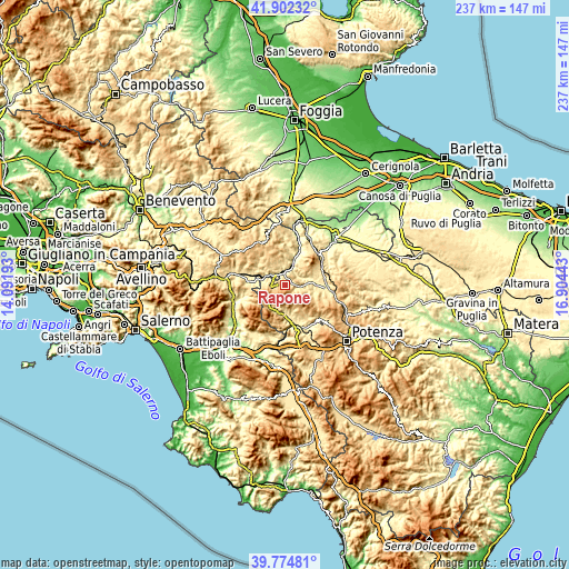
| \ | Map #1 | Topo.Map |
| Scale [m] | 369..1257 m | × |
| Scale [ft] | 1211..4124 ft | × |
| Average | 782.3 m = 2567 ft | × |
| Width | 7.39 km = 4.6 mi | 236.6 km = 147 mi |
| Height | 7.39 km = 4.6 mi | 236.5 km = 147 mi |
| ↑Max Latitude | 40.880334° | 41.90232° |
| Latitude at center | 40.8471° | 40.8471° |
| ↓Min Latitude | 40.813849° | 39.77481° |
| ← Min Longitude | 15.454235° | 14.09193° |
| Longitude center | 15.49818° | 15.49818° |
| →Max Longitude | 15.542125° | 16.90443° |
Nearby cities:
Cities around Rapone sort by population:
• Calitri elevation 692 m
11.8 km,  317°
317°
• Muro Lucano 577 m
10.4 km,  184°
184°
• Atella 496 m
13.4 km,  74°
74°
• Bella 674 m
10.3 km,  159°
159°
• Pescopagano 947 m
8.4 km,  260°
260°
• Sant'Andrea di Conza 661 m
10.8 km,  268°
268°
• San Fele 884 m
4.9 km,  133°
133°
• Ruvo del Monte 628 m
3.7 km,  85°
85°
• Castelgrande 929 m
8.8 km,  219°
219°
• Nuova Conza della Campania 486 m
13.7 km,  275°
275°
• Santomenna 602 m
15.1 km,  252°
252°
• Cairano 745 m
12 km,  296°
296°
Multilingual:
 En español:
Rapone elevación 811 m.
 En France:
Rapone élévation 811 m.


Sources and notes:
- [note 1] Map square and city borders are not equal. Map elevation data is calculated only from area inside that square.
- [src 1] Elevation data from geonames database provided with same terms of usage.
- [src 2] The elevation map of Rapone is generated using elevation data from NASA's 3 arcsec (90m) resolution SRTM data.
- [src 3] Base (background) map © OpenStreetMap contributors tiles are generated by Geofabrik and OpenTopoMap.
Copyright & License:
This Rapone Elevation Map is licensed under CC BY-SA. You may reuse any part from this page, if you give a proper credit by linking to this URL:
 More info on terms of use page.