Roccaforte Ligure elevation
Roccaforte Ligure (Piedmont, Provincia di Alessandria), Italy elevation is 708 meters and Roccaforte Ligure elevation in feet is 2323 ft above sea level [src 1]. Roccaforte Ligure is a seat of a third-order administrative division (feature code) with elevation that is 386 meters (1266 ft) bigger than average city elevation in Italy.
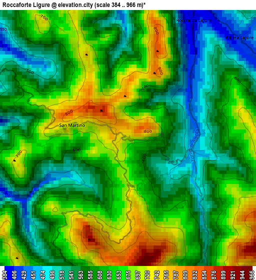
Below is the Elevation map of Roccaforte Ligure, which displays elevation range with different colors. Scale of the first map is from 384 to 966 m (1260 to 3169 ft) with average elevation of 620.2 meters (=2035 ft) [note 1]
These maps also provides idea of topography and contour of this city, they are displayed at different zoom levels. More info about maps, scale and edge coordinates you can find below images.
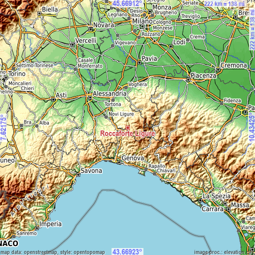
| \ | Map #1 | Topo.Map |
| Scale [m] | 384..966 m | × |
| Scale [ft] | 1260..3169 ft | × |
| Average | 620.2 m = 2035 ft | × |
| Width | 6.95 km = 4.3 mi | 222.4 km = 138.2 mi |
| Height | 6.95 km = 4.3 mi | 222.4 km = 138.2 mi |
| ↑Max Latitude | 44.70904° | 45.66912° |
| Latitude at center | 44.6778° | 44.6778° |
| ↓Min Latitude | 44.646543° | 43.66923° |
| ← Min Longitude | 8.984055° | 7.62175° |
| Longitude center | 9.028° | 9.028° |
| →Max Longitude | 9.071945° | 10.43425° |
Nearby cities:
Cities around Roccaforte Ligure sort by population:
• Ronco Scrivia elevation 329 m
9.4 km,  220°
220°
• Isola del Cantone 295 m
6.5 km,  239°
239°
• Borghetto di Borbera 289 m
8.8 km,  310°
310°
• Crocefieschi 751 m
10.8 km,  181°
181°
• Cabella Ligure 485 m
5.4 km,  93°
93°
• Grondona 307 m
5.4 km,  292°
292°
• Cantalupo Ligure 381 m
4.7 km,  17°
17°
• Vobbia 455 m
8.6 km,  174°
174°
• Rocchetta Ligure 398 m
3.7 km,  29°
29°
• Dernice 586 m
10 km,  9°
9°
• Albera Ligure 422 m
4.1 km,  49°
49°
• Mongiardino Ligure 672 m
5.6 km,  149°
149°
Multilingual:
 En español:
Roccaforte Ligure elevación 708 m.
 En France:
Roccaforte Ligure élévation 708 m.
 Auf Deutsch:
Roccaforte Ligure höhe über dem Meeresspiegel ist 708 m.

Sources and notes:
- [note 1] Map square and city borders are not equal. Map elevation data is calculated only from area inside that square.
- [src 1] Elevation data from geonames database provided with same terms of usage.
- [src 2] The elevation map of Roccaforte Ligure is generated using elevation data from NASA's 3 arcsec (90m) resolution SRTM data.
- [src 3] Base (background) map © OpenStreetMap contributors tiles are generated by Geofabrik and OpenTopoMap.
Copyright & License:
This Roccaforte Ligure Elevation Map is licensed under CC BY-SA. You may reuse any part from this page, if you give a proper credit by linking to this URL:
 More info on terms of use page.