Rolo elevation
Rolo (Emilia-Romagna, Provincia di Reggio Emilia), Italy elevation is 22 meters and Rolo elevation in feet is 72 ft above sea level [src 1]. Rolo is a seat of a third-order administrative division (feature code) with elevation that is 300 meters (984 ft) smaller than average city elevation in Italy.
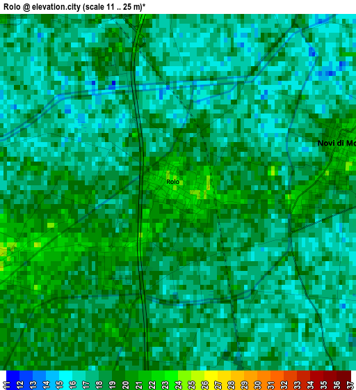
Below is the Elevation map of Rolo, which displays elevation range with different colors. Scale of the first map is from 11 to 25 m (36 to 82 ft) with average elevation of 17.8 meters (=58 ft) [note 1]
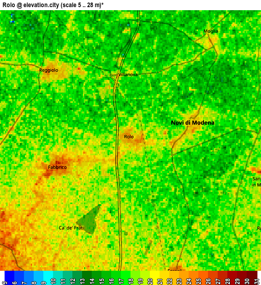
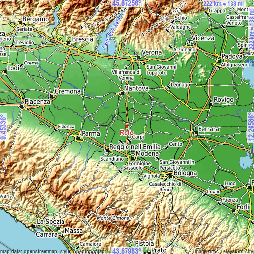
These maps also provides idea of topography and contour of this city, they are displayed at different zoom levels. More info about maps, scale and edge coordinates you can find below images.
| \ | Map #1 | Map #2 | Topo.Map |
| Scale [m] | 11..25 m | 5..28 m | × |
| Scale [ft] | 36..82 ft | 16..92 ft | × |
| Average | 17.8 m = 58 ft | 17.8 m = 58 ft | × |
| Width | 6.92 km = 4.3 mi | 13.85 km = 8.6 mi | 221.6 km = 137.7 mi |
| Height | 6.92 km = 4.3 mi | 13.85 km = 8.6 mi | 221.6 km = 137.7 mi |
| ↑Max Latitude | 44.915948° | 44.947059° | 45.87256° |
| Latitude at center | 44.88482° | 44.88482° | 44.88482° |
| ↓Min Latitude | 44.853675° | 44.822513° | 43.87983° |
| ← Min Longitude | 10.815665° | 10.771719° | 9.45336° |
| Longitude center | 10.85961° | 10.85961° | 10.85961° |
| →Max Longitude | 10.903555° | 10.947501° | 12.26586° |
Nearby cities:
Cities around Rolo sort by population:
• Reggiolo elevation 21 m
5.4 km,  313°
313°
• Fabbrico 26 m
4.2 km,  250°
250°
• Novi di Modena 21 m
3.2 km,  80°
80°
• Gonzaga 19 m
8.1 km,  336°
336°
• Rio Saliceto 26 m
9.3 km,  208°
208°
• Campagnola Emilia 26 m
9 km,  235°
235°
• Moglia 16 m
7.1 km,  37°
37°
• Fossoli 25 m
7.4 km,  161°
161°
• Rovereto 19 m
9.2 km,  128°
128°
• San Possidonio 21 m
9.6 km,  97°
97°
• Migliarina 23 m
8.5 km,  192°
192°
• Bondeno 17 m
5.7 km,  0°
0°
Multilingual:
 En español:
Rolo elevación 22 m.
 En France:
Rolo élévation 22 m.


Sources and notes:
- [note 1] Map square and city borders are not equal. Map elevation data is calculated only from area inside that square.
- [src 1] Elevation data from geonames database provided with same terms of usage.
- [src 2] The elevation map of Rolo is generated using elevation data from NASA's 3 arcsec (90m) resolution SRTM data.
- [src 3] Base (background) map © OpenStreetMap contributors tiles are generated by Geofabrik and OpenTopoMap.
Copyright & License:
This Rolo Elevation Map is licensed under CC BY-SA. You may reuse any part from this page, if you give a proper credit by linking to this URL:
 More info on terms of use page.