San Marcello elevation
San Marcello (The Marches, Provincia di Ancona), Italy elevation is 200 meters and San Marcello elevation in feet is 656 ft above sea level [src 1]. San Marcello is a seat of a third-order administrative division (feature code) with elevation that is 122 meters (400 ft) smaller than average city elevation in Italy.
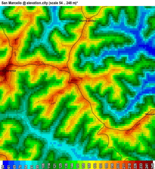
Below is the Elevation map of San Marcello, which displays elevation range with different colors. Scale of the first map is from 54 to 248 m (177 to 814 ft) with average elevation of 136.9 meters (=449 ft) [note 1]
These maps also provides idea of topography and contour of this city, they are displayed at different zoom levels. More info about maps, scale and edge coordinates you can find below images.
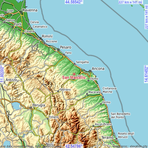
| \ | Map #1 | Topo.Map |
| Scale [m] | 54..248 m | × |
| Scale [ft] | 177..814 ft | × |
| Average | 136.9 m = 449 ft | × |
| Width | 7.08 km = 4.4 mi | 226.6 km = 140.8 mi |
| Height | 7.08 km = 4.4 mi | 226.5 km = 140.7 mi |
| ↑Max Latitude | 43.607089° | 44.58542° |
| Latitude at center | 43.57526° | 43.57526° |
| ↓Min Latitude | 43.543415° | 42.54786° |
| ← Min Longitude | 13.164325° | 11.80202° |
| Longitude center | 13.20827° | 13.20827° |
| →Max Longitude | 13.252215° | 14.61452° |
Nearby cities:
Cities around San Marcello sort by population:
• Jesi elevation 95 m
6.6 km,  154°
154°
• Chiaravalle 23 m
9.8 km,  72°
72°
• Moie 114 m
10 km,  217°
217°
• Borghetto 52 m
7.2 km, 69°
• Ostra 162 m
6.1 km,  318°
318°
• Stazione 95 m
9.5 km,  208°
208°
• Monsano 162 m
3.8 km,  112°
112°
• Morro d'Alba 192 m
2.8 km,  8°
8°
• Monte San Vito 139 m
5.6 km,  59°
59°
• Casine 59 m
8.1 km, 320°
• Belvedere Ostrense 225 m
3.3 km,  277°
277°
• Pianello 45 m
8.4 km,  312°
312°
Multilingual:
 En español:
San Marcello elevación 200 m.
 En France:
San Marcello élévation 200 m.
 Auf Deutsch:
San Marcello höhe über dem Meeresspiegel ist 200 m.

Sources and notes:
- [note 1] Map square and city borders are not equal. Map elevation data is calculated only from area inside that square.
- [src 1] Elevation data from geonames database provided with same terms of usage.
- [src 2] The elevation map of San Marcello is generated using elevation data from NASA's 3 arcsec (90m) resolution SRTM data.
- [src 3] Base (background) map © OpenStreetMap contributors tiles are generated by Geofabrik and OpenTopoMap.
Copyright & License:
This San Marcello Elevation Map is licensed under CC BY-SA. You may reuse any part from this page, if you give a proper credit by linking to this URL:
 More info on terms of use page.