Santa Croce sull'Arno elevation
Santa Croce sull'Arno (Tuscany, Province of Pisa), Italy elevation is 19 meters and Santa Croce sull'Arno elevation in feet is 62 ft above sea level [src 1]. Santa Croce sull'Arno is a seat of a third-order administrative division (feature code) with elevation that is 303 meters (994 ft) smaller than average city elevation in Italy.
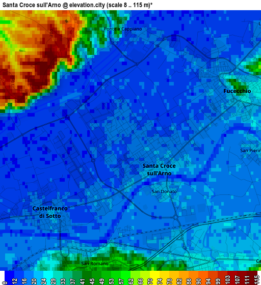
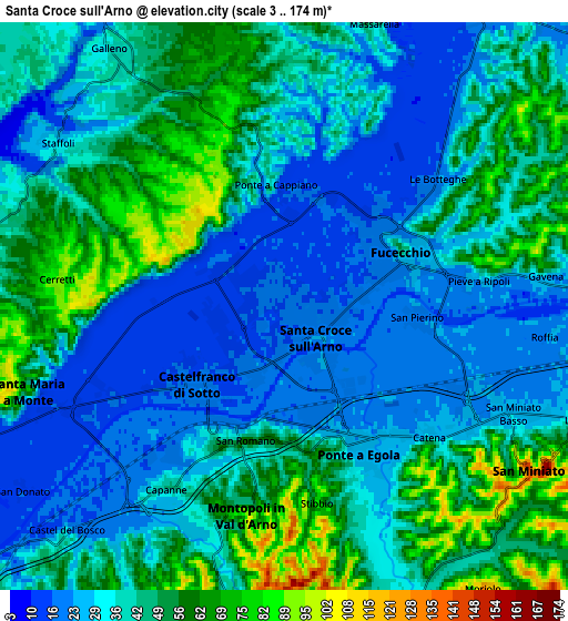
Below is the Elevation map of Santa Croce sull'Arno, which displays elevation range with different colors. Scale of the first map is from 8 to 115 m (26 to 377 ft) with average elevation of 25.8 meters (=85 ft) [note 1]
These maps also provides idea of topography and contour of this city, they are displayed at different zoom levels. More info about maps, scale and edge coordinates you can find below images.
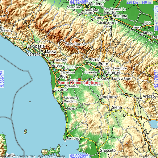
| \ | Map #1 | Map #2 | Topo.Map |
| Scale [m] | 8..115 m | 3..174 m | × |
| Scale [ft] | 26..377 ft | 10..571 ft | × |
| Average | 25.8 m = 85 ft | 40.1 m = 132 ft | × |
| Width | 7.06 km = 4.4 mi | 14.13 km = 8.8 mi | 226 km = 140.4 mi |
| Height | 7.06 km = 4.4 mi | 14.13 km = 8.8 mi | 226 km = 140.4 mi |
| ↑Max Latitude | 43.748844° | 43.78058° | 44.72485° |
| Latitude at center | 43.71709° | 43.71709° | 43.71709° |
| ↓Min Latitude | 43.68532° | 43.653532° | 42.69209° |
| ← Min Longitude | 10.728475° | 10.684529° | 9.36617° |
| Longitude center | 10.77242° | 10.77242° | 10.77242° |
| →Max Longitude | 10.816365° | 10.860311° | 12.17867° |
Nearby cities:
Cities around Santa Croce sull'Arno sort by population:
• San Miniato Basso elevation 28 m
6.1 km,  115°
115°
• San Miniato 125 m
7.5 km, 123°
• Fucecchio 18 m
2.7 km,  48°
48°
• Castelfranco di Sotto 16 m
2.6 km,  234°
234°
• Santa Maria a Monte 86 m
6.5 km,  261°
261°
• Montopoli 65 m
5.2 km,  200°
200°
• San Pierino 20 m
3.3 km,  95°
95°
• San Donato 21 m
2 km,  142°
142°
• Stabbia 21 m
8.8 km,  34°
34°
• San Romano 46 m
3.1 km,  185°
185°
• Marcignana 29 m
9 km,  89°
89°
• Marti 97 m
7.4 km, 200°
Multilingual:
 En español:
Santa Croce sull'Arno elevación 19 m.
 En France:
Santa Croce sull'Arno élévation 19 m.
 Auf Deutsch:
Santa Croce sull'Arno höhe über dem Meeresspiegel ist 19 m.
 На русском:
Santa Croce sull'Arno высота над уровнем моря 19 м
Sources and notes:
- [note 1] Map square and city borders are not equal. Map elevation data is calculated only from area inside that square.
- [src 1] Elevation data from geonames database provided with same terms of usage.
- [src 2] The elevation map of Santa Croce sull'Arno is generated using elevation data from NASA's 3 arcsec (90m) resolution SRTM data.
- [src 3] Base (background) map © OpenStreetMap contributors tiles are generated by Geofabrik and OpenTopoMap.
Copyright & License:
This Santa Croce sull'Arno Elevation Map is licensed under CC BY-SA. You may reuse any part from this page, if you give a proper credit by linking to this URL:
 More info on terms of use page.