Santa Fiora elevation
Santa Fiora (Tuscany, Provincia di Grosseto), Italy elevation is 690 meters and Santa Fiora elevation in feet is 2264 ft above sea level [src 1]. Santa Fiora is a seat of a third-order administrative division (feature code) with elevation that is 368 meters (1207 ft) bigger than average city elevation in Italy.
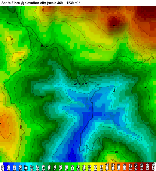
Below is the Elevation map of Santa Fiora, which displays elevation range with different colors. Scale of the first map is from 469 to 1239 m (1539 to 4065 ft) with average elevation of 784.6 meters (=2574 ft) [note 1]
These maps also provides idea of topography and contour of this city, they are displayed at different zoom levels. More info about maps, scale and edge coordinates you can find below images.
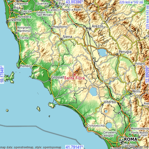
| \ | Map #1 | Topo.Map |
| Scale [m] | 469..1239 m | × |
| Scale [ft] | 1539..4065 ft | × |
| Average | 784.6 m = 2574 ft | × |
| Width | 7.17 km = 4.5 mi | 229.3 km = 142.5 mi |
| Height | 7.17 km = 4.5 mi | 229.3 km = 142.5 mi |
| ↑Max Latitude | 42.863509° | 43.85396° |
| Latitude at center | 42.83129° | 42.83129° |
| ↓Min Latitude | 42.799054° | 41.79141° |
| ← Min Longitude | 11.540795° | 10.17849° |
| Longitude center | 11.58474° | 11.58474° |
| →Max Longitude | 11.628685° | 12.99099° |
Nearby cities:
Cities around Santa Fiora sort by population:
• Abbadia San Salvatore elevation 836 m
9 km,  52°
52°
• Castel del Piano 622 m
7.7 km,  331°
331°
• Piancastagnaio 785 m
8.9 km,  75°
75°
• Arcidosso 668 m
6 km,  318°
318°
• Castell'Azzara 801 m
11.3 km,  125°
125°
• Sorano 409 m
20 km,  146°
146°
• Radicofani 775 m
16.6 km,  64°
64°
• Cinigiano 304 m
17 km,  292°
292°
• Castiglione d'Orcia 534 m
19.4 km,  7°
7°
• Semproniano 586 m
11.9 km,  197°
197°
• Seggiano 486 m
11.1 km,  348°
348°
• Roccalbegna 543 m
8 km,  231°
231°
Multilingual:
 En español:
Santa Fiora elevación 690 m.
 En France:
Santa Fiora élévation 690 m.
 Auf Deutsch:
Santa Fiora höhe über dem Meeresspiegel ist 690 m.

Sources and notes:
- [note 1] Map square and city borders are not equal. Map elevation data is calculated only from area inside that square.
- [src 1] Elevation data from geonames database provided with same terms of usage.
- [src 2] The elevation map of Santa Fiora is generated using elevation data from NASA's 3 arcsec (90m) resolution SRTM data.
- [src 3] Base (background) map © OpenStreetMap contributors tiles are generated by Geofabrik and OpenTopoMap.
Copyright & License:
This Santa Fiora Elevation Map is licensed under CC BY-SA. You may reuse any part from this page, if you give a proper credit by linking to this URL:
 More info on terms of use page.