Sant'Agata Bolognese elevation
Sant'Agata Bolognese (Emilia-Romagna, Bologna), Italy elevation is 22 meters and Sant'Agata Bolognese elevation in feet is 72 ft above sea level [src 1]. Sant'Agata Bolognese is a seat of a third-order administrative division (feature code) with elevation that is 300 meters (984 ft) smaller than average city elevation in Italy.
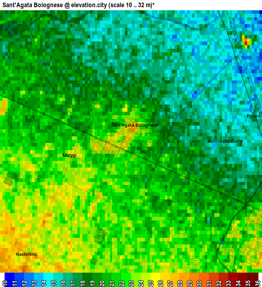
Below is the Elevation map of Sant'Agata Bolognese, which displays elevation range with different colors. Scale of the first map is from 10 to 32 m (33 to 105 ft) with average elevation of 19.5 meters (=64 ft) [note 1]
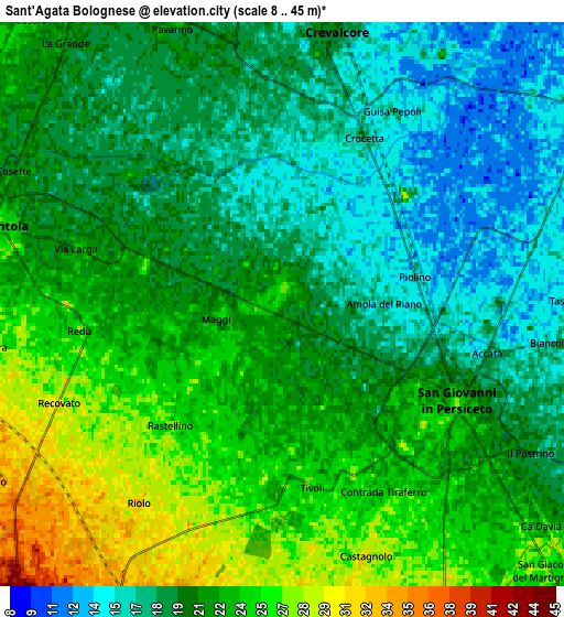
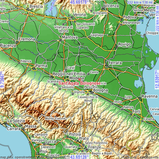
These maps also provides idea of topography and contour of this city, they are displayed at different zoom levels. More info about maps, scale and edge coordinates you can find below images.
| \ | Map #1 | Map #2 | Topo.Map |
| Scale [m] | 10..32 m | 8..45 m | × |
| Scale [ft] | 33..105 ft | 26..148 ft | × |
| Average | 19.5 m = 64 ft | 20.9 m = 69 ft | × |
| Width | 6.95 km = 4.3 mi | 13.9 km = 8.6 mi | 222.4 km = 138.2 mi |
| Height | 6.95 km = 4.3 mi | 13.9 km = 8.6 mi | 222.4 km = 138.2 mi |
| ↑Max Latitude | 44.691409° | 44.722642° | 45.65178° |
| Latitude at center | 44.66016° | 44.66016° | 44.66016° |
| ↓Min Latitude | 44.628894° | 44.597611° | 43.65128° |
| ← Min Longitude | 11.088975° | 11.045029° | 9.72667° |
| Longitude center | 11.13292° | 11.13292° | 11.13292° |
| →Max Longitude | 11.176865° | 11.220811° | 12.53917° |
Nearby cities:
Cities around Sant'Agata Bolognese sort by population:
• Castelfranco Emilia elevation 44 m
9.8 km,  221°
221°
• San Giovanni in Persiceto 23 m
4.7 km,  120°
120°
• Nonantola 25 m
7.8 km,  284°
284°
• Crevalcore 20 m
6.7 km,  9°
9°
• Decima 18 m
9.5 km,  53°
53°
• Ravarino 20 m
7.8 km,  337°
337°
• Bomporto 21 m
11.2 km,  317°
317°
• Osteria Nuova 28 m
11.8 km,  135°
135°
• Sala Bolognese 21 m
11.1 km, 117°
• Manzolino 37 m
7.6 km,  200°
200°
• Cavazzona 42 m
9.7 km,  186°
186°
• Gaggio 35 m
9.9 km,  253°
253°
Multilingual:
 En español:
Sant'Agata Bolognese elevación 22 m.
 En France:
Sant'Agata Bolognese élévation 22 m.
 Auf Deutsch:
Sant'Agata-Bolognese höhe über dem Meeresspiegel ist 22 m.
 На русском:
Sant'Agata Bolognese высота над уровнем моря 22 м
Sources and notes:
- [note 1] Map square and city borders are not equal. Map elevation data is calculated only from area inside that square.
- [src 1] Elevation data from geonames database provided with same terms of usage.
- [src 2] The elevation map of Sant'Agata Bolognese is generated using elevation data from NASA's 3 arcsec (90m) resolution SRTM data.
- [src 3] Base (background) map © OpenStreetMap contributors tiles are generated by Geofabrik and OpenTopoMap.
Copyright & License:
This Sant'Agata Bolognese Elevation Map is licensed under CC BY-SA. You may reuse any part from this page, if you give a proper credit by linking to this URL:
 More info on terms of use page.