Sant'Apollinare elevation
Sant'Apollinare (Latium, Provincia di Frosinone), Italy elevation is 54 meters and Sant'Apollinare elevation in feet is 177 ft above sea level [src 1]. Sant'Apollinare is a seat of a third-order administrative division (feature code) with elevation that is 268 meters (879 ft) smaller than average city elevation in Italy.
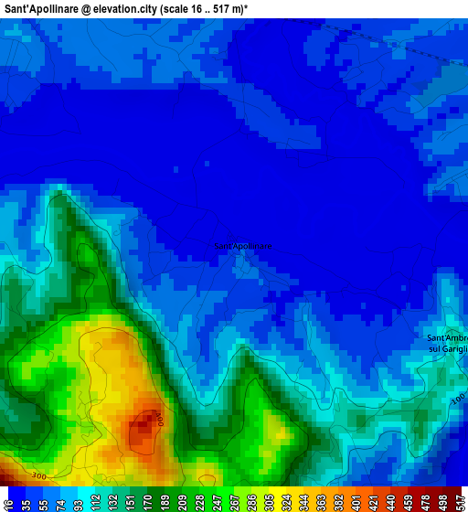
Below is the Elevation map of Sant'Apollinare, which displays elevation range with different colors. Scale of the first map is from 16 to 517 m (52 to 1696 ft) with average elevation of 95.9 meters (=315 ft) [note 1]
These maps also provides idea of topography and contour of this city, they are displayed at different zoom levels. More info about maps, scale and edge coordinates you can find below images.
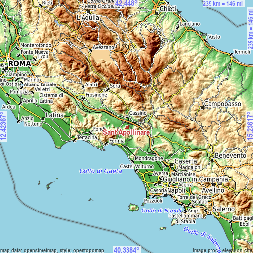
| \ | Map #1 | Topo.Map |
| Scale [m] | 16..517 m | × |
| Scale [ft] | 52..1696 ft | × |
| Average | 95.9 m = 315 ft | × |
| Width | 7.33 km = 4.6 mi | 234.6 km = 145.8 mi |
| Height | 7.33 km = 4.6 mi | 234.6 km = 145.8 mi |
| ↑Max Latitude | 41.434715° | 42.448° |
| Latitude at center | 41.40176° | 41.40176° |
| ↓Min Latitude | 41.368789° | 40.3384° |
| ← Min Longitude | 13.785975° | 12.42367° |
| Longitude center | 13.82992° | 13.82992° |
| →Max Longitude | 13.873865° | 15.23617° |
Nearby cities:
Cities around Sant'Apollinare sort by population:
• Cassino elevation 40 m
9.3 km,  359°
359°
• San Bartolomeo 55 m
9.3 km,  14°
14°
• San Giorgio a Liri 41 m
5.9 km,  274°
274°
• Coreno Ausonio 309 m
7.5 km,  216°
216°
• Ausonia 165 m
8.3 km,  233°
233°
• Castelnuovo Parano 322 m
6.6 km,  247°
247°
• Pignataro Interamna 75 m
5.5 km,  318°
318°
• Sant'Ambrogio sul Garigliano 92 m
3.4 km,  104°
104°
• Bivio Mortola 75 m
5.6 km, 97°
• Sant'Andrea del Garigliano 146 m
3.8 km,  164°
164°
• Vallemaio 293 m
4.3 km,  204°
204°
• Casali 315 m
6.8 km, 247°
Multilingual:
 En español:
Sant'Apollinare elevación 54 m.
 En France:
Sant'Apollinare élévation 54 m.
 Auf Deutsch:
Sant'Apollinare höhe über dem Meeresspiegel ist 54 m.

Sources and notes:
- [note 1] Map square and city borders are not equal. Map elevation data is calculated only from area inside that square.
- [src 1] Elevation data from geonames database provided with same terms of usage.
- [src 2] The elevation map of Sant'Apollinare is generated using elevation data from NASA's 3 arcsec (90m) resolution SRTM data.
- [src 3] Base (background) map © OpenStreetMap contributors tiles are generated by Geofabrik and OpenTopoMap.
Copyright & License:
This Sant'Apollinare Elevation Map is licensed under CC BY-SA. You may reuse any part from this page, if you give a proper credit by linking to this URL:
 More info on terms of use page.