Santhià elevation
Santhià (Piedmont, Provincia di Vercelli), Italy elevation is 187 meters and Santhià elevation in feet is 614 ft above sea level [src 1]. Santhià is a seat of a third-order administrative division (feature code) with elevation that is 135 meters (443 ft) smaller than average city elevation in Italy.
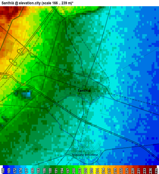
Below is the Elevation map of Santhià, which displays elevation range with different colors. Scale of the first map is from 166 to 239 m (545 to 784 ft) with average elevation of 186 meters (=610 ft) [note 1]
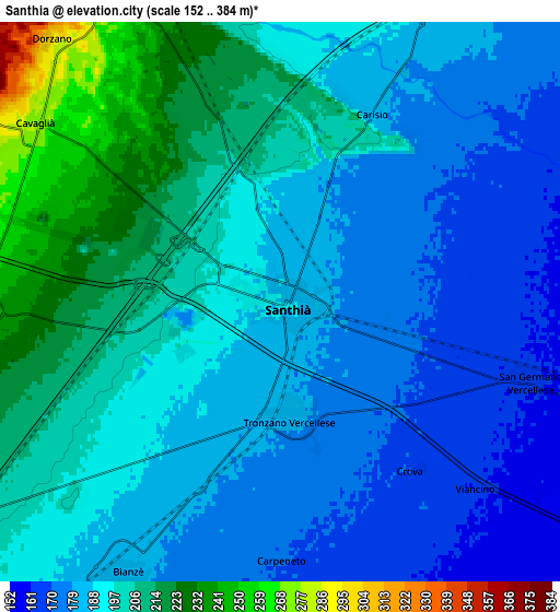
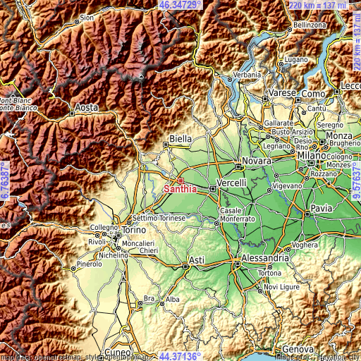
These maps also provides idea of topography and contour of this city, they are displayed at different zoom levels. More info about maps, scale and edge coordinates you can find below images.
| \ | Map #1 | Map #2 | Topo.Map |
| Scale [m] | 166..239 m | 152..384 m | × |
| Scale [ft] | 545..784 ft | 499..1260 ft | × |
| Average | 186 m = 610 ft | 192.4 m = 631 ft | × |
| Width | 6.87 km = 4.3 mi | 13.73 km = 8.5 mi | 219.7 km = 136.5 mi |
| Height | 6.87 km = 4.3 mi | 13.73 km = 8.5 mi | 219.7 km = 136.5 mi |
| ↑Max Latitude | 45.398815° | 45.429664° | 46.34729° |
| Latitude at center | 45.36795° | 45.36795° | 45.36795° |
| ↓Min Latitude | 45.337068° | 45.306169° | 44.37136° |
| ← Min Longitude | 8.126175° | 8.082229° | 6.76387° |
| Longitude center | 8.17012° | 8.17012° | 8.17012° |
| →Max Longitude | 8.214065° | 8.258011° | 9.57637° |
Nearby cities:
Cities around Santhià sort by population:
• Tronzano Vercellese elevation 181 m
2.9 km,  174°
174°
• Cavaglià 279 m
7.4 km,  304°
304°
• Borgo d'Ale 243 m
9.5 km,  257°
257°
• Alice Castello 253 m
7.6 km,  270°
270°
• Bianzè 185 m
7.7 km,  209°
209°
• San Germano Vercellese 165 m
6.3 km,  107°
107°
• Salussola 260 m
9.9 km,  332°
332°
• Carisio 182 m
5.2 km,  26°
26°
• Roppolo 312 m
9.8 km,  306°
306°
• Dorzano 300 m
8.5 km,  319°
319°
• Crova 170 m
5.2 km,  142°
142°
• Salasco 156 m
8.7 km,  122°
122°
Multilingual:
 En español:
Santhià elevación 187 m.
 En France:
Santhià élévation 187 m.


Sources and notes:
- [note 1] Map square and city borders are not equal. Map elevation data is calculated only from area inside that square.
- [src 1] Elevation data from geonames database provided with same terms of usage.
- [src 2] The elevation map of Santhià is generated using elevation data from NASA's 3 arcsec (90m) resolution SRTM data.
- [src 3] Base (background) map © OpenStreetMap contributors tiles are generated by Geofabrik and OpenTopoMap.
Copyright & License:
This Santhià Elevation Map is licensed under CC BY-SA. You may reuse any part from this page, if you give a proper credit by linking to this URL:
 More info on terms of use page.