Selci elevation
Selci (Latium, Provincia di Rieti), Italy elevation is 250 meters and Selci elevation in feet is 820 ft above sea level [src 1]. Selci is a seat of a third-order administrative division (feature code) with elevation that is 72 meters (236 ft) smaller than average city elevation in Italy.
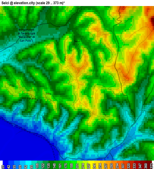
Below is the Elevation map of Selci, which displays elevation range with different colors. Scale of the first map is from 29 to 373 m (95 to 1224 ft) with average elevation of 155.7 meters (=511 ft) [note 1]
These maps also provides idea of topography and contour of this city, they are displayed at different zoom levels. More info about maps, scale and edge coordinates you can find below images.
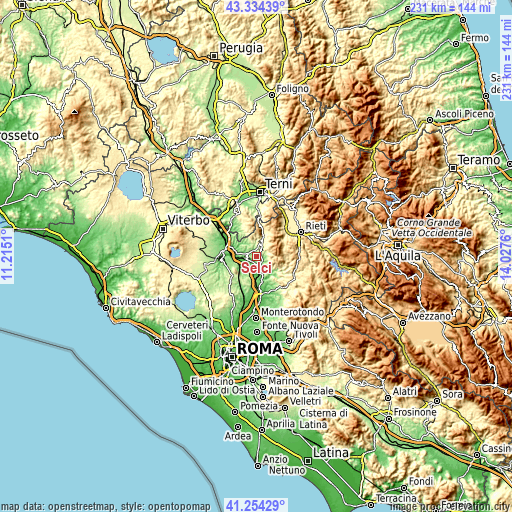
| \ | Map #1 | Topo.Map |
| Scale [m] | 29..373 m | × |
| Scale [ft] | 95..1224 ft | × |
| Average | 155.7 m = 511 ft | × |
| Width | 7.23 km = 4.5 mi | 231.3 km = 143.7 mi |
| Height | 7.23 km = 4.5 mi | 231.3 km = 143.7 mi |
| ↑Max Latitude | 42.335423° | 43.33439° |
| Latitude at center | 42.30293° | 42.30293° |
| ↓Min Latitude | 42.27042° | 41.25429° |
| ← Min Longitude | 12.577405° | 11.2151° |
| Longitude center | 12.62135° | 12.62135° |
| →Max Longitude | 12.665295° | 14.0276° |
Nearby cities:
Cities around Selci sort by population:
• Poggio Mirteto elevation 273 m
6.8 km,  125°
125°
• Forano 214 m
2.3 km,  255°
255°
• Cantalupo in Sabina 254 m
2 km,  77°
77°
• Stimigliano 209 m
4.8 km,  267°
267°
• Ponzano Romano 180 m
6.6 km,  219°
219°
• Poggio Catino 527 m
6.4 km,  98°
98°
• Collevecchio 226 m
6.6 km,  301°
301°
• Casperia 390 m
5.6 km,  45°
45°
• Filacciano 165 m
5.7 km,  198°
198°
• Torri in Sabina 277 m
5.6 km,  17°
17°
• Roccantica 443 m
6.3 km,  71°
71°
• Tarano 230 m
6.3 km,  339°
339°
Multilingual:
 En español:
Selci elevación 250 m.
 En France:
Selci élévation 250 m.


Sources and notes:
- [note 1] Map square and city borders are not equal. Map elevation data is calculated only from area inside that square.
- [src 1] Elevation data from geonames database provided with same terms of usage.
- [src 2] The elevation map of Selci is generated using elevation data from NASA's 3 arcsec (90m) resolution SRTM data.
- [src 3] Base (background) map © OpenStreetMap contributors tiles are generated by Geofabrik and OpenTopoMap.
Copyright & License:
This Selci Elevation Map is licensed under CC BY-SA. You may reuse any part from this page, if you give a proper credit by linking to this URL:
 More info on terms of use page.