Stradella elevation
Stradella (Lombardy, Provincia di Pavia), Italy elevation is 90 meters and Stradella elevation in feet is 295 ft above sea level [src 1]. Stradella is a seat of a third-order administrative division (feature code) with elevation that is 232 meters (761 ft) smaller than average city elevation in Italy.
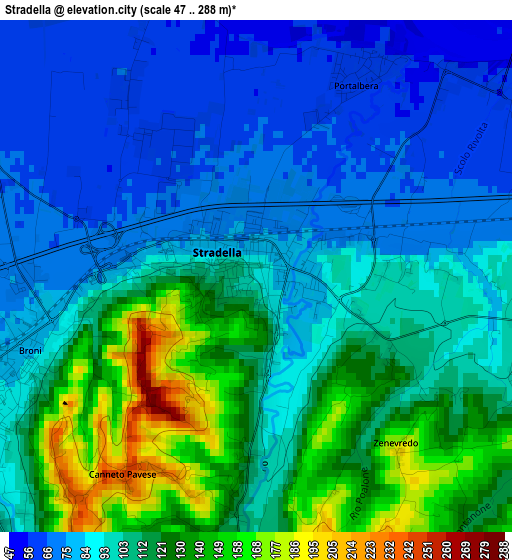
Below is the Elevation map of Stradella, which displays elevation range with different colors. Scale of the first map is from 47 to 288 m (154 to 945 ft) with average elevation of 101.8 meters (=334 ft) [note 1]
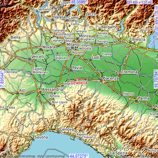
These maps also provides idea of topography and contour of this city, they are displayed at different zoom levels. More info about maps, scale and edge coordinates you can find below images.
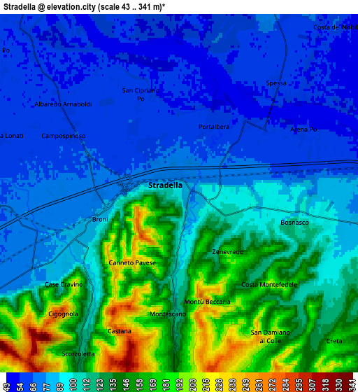
| \ | Map #1 | Map #2 | Topo.Map |
| Scale [m] | 47..288 m | 43..341 m | × |
| Scale [ft] | 154..945 ft | 141..1119 ft | × |
| Average | 101.8 m = 334 ft | 105.6 m = 346 ft | × |
| Width | 6.9 km = 4.3 mi | 13.8 km = 8.6 mi | 220.8 km = 137.2 mi |
| Height | 6.9 km = 4.3 mi | 13.8 km = 8.6 mi | 220.8 km = 137.2 mi |
| ↑Max Latitude | 45.105475° | 45.136484° | 46.0589° |
| Latitude at center | 45.07445° | 45.07445° | 45.07445° |
| ↓Min Latitude | 45.043408° | 45.012349° | 44.07275° |
| ← Min Longitude | 9.257745° | 9.213799° | 7.89544° |
| Longitude center | 9.30169° | 9.30169° | 9.30169° |
| →Max Longitude | 9.345635° | 9.389581° | 10.70794° |
Nearby cities:
Cities around Stradella sort by population:
• Broni elevation 82 m
3.5 km,  250°
250°
• Portalbera 62 m
2.9 km,  25°
25°
• Canneto Pavese 246 m
3.2 km,  214°
214°
• Campospinoso 64 m
4.9 km,  296°
296°
• Montù Beccaria 213 m
4.3 km,  168°
168°
• Arena Po 60 m
5.3 km,  65°
65°
• San Cipriano Po 60 m
4.2 km,  337°
337°
• Canneto 229 m
3.1 km, 212°
• Spessa 62 m
5.7 km,  40°
40°
• Zenevredo 187 m
3 km,  139°
139°
• Bosnasco 120 m
4.5 km,  104°
104°
• Montescano 198 m
4.9 km,  196°
196°
Multilingual:
 En español:
Stradella elevación 90 m.
 En France:
Stradella élévation 90 m.
 Auf Deutsch:
Stradella höhe über dem Meeresspiegel ist 90 m.

Sources and notes:
- [note 1] Map square and city borders are not equal. Map elevation data is calculated only from area inside that square.
- [src 1] Elevation data from geonames database provided with same terms of usage.
- [src 2] The elevation map of Stradella is generated using elevation data from NASA's 3 arcsec (90m) resolution SRTM data.
- [src 3] Base (background) map © OpenStreetMap contributors tiles are generated by Geofabrik and OpenTopoMap.
Copyright & License:
This Stradella Elevation Map is licensed under CC BY-SA. You may reuse any part from this page, if you give a proper credit by linking to this URL:
 More info on terms of use page.