Surbo elevation
Surbo (Apulia, Provincia di Lecce), Italy elevation is 44 meters and Surbo elevation in feet is 144 ft above sea level [src 1]. Surbo is a seat of a third-order administrative division (feature code) with elevation that is 278 meters (912 ft) smaller than average city elevation in Italy.
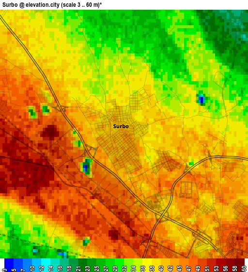
Below is the Elevation map of Surbo, which displays elevation range with different colors. Scale of the first map is from 3 to 60 m (10 to 197 ft) with average elevation of 39.8 meters (=131 ft) [note 1]
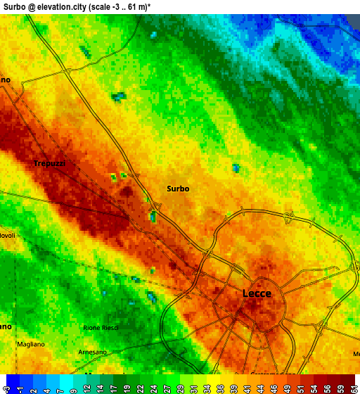
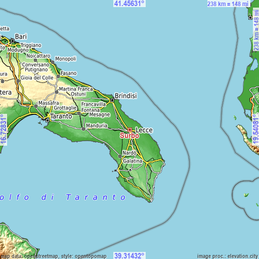
These maps also provides idea of topography and contour of this city, they are displayed at different zoom levels. More info about maps, scale and edge coordinates you can find below images.
| \ | Map #1 | Map #2 | Topo.Map |
| Scale [m] | 3..60 m | -3..61 m | × |
| Scale [ft] | 10..197 ft | -10..200 ft | × |
| Average | 39.8 m = 131 ft | 32.9 m = 108 ft | × |
| Width | 7.44 km = 4.6 mi | 14.89 km = 9.3 mi | 238.2 km = 148 mi |
| Height | 7.44 km = 4.6 mi | 14.89 km = 9.3 mi | 238.2 km = 148 mi |
| ↑Max Latitude | 40.427291° | 40.460735° | 41.45631° |
| Latitude at center | 40.39383° | 40.39383° | 40.39383° |
| ↓Min Latitude | 40.360353° | 40.326859° | 39.31432° |
| ← Min Longitude | 18.090615° | 18.046669° | 16.72831° |
| Longitude center | 18.13456° | 18.13456° | 18.13456° |
| →Max Longitude | 18.178505° | 18.222451° | 19.54081° |
Nearby cities:
Cities around Surbo sort by population:
• Lecce elevation 53 m
5.4 km,  143°
143°
• Squinzano 47 m
9.2 km,  300°
300°
• Trepuzzi 57 m
5.1 km,  284°
284°
• Monteroni di Lecce 38 m
9.1 km,  203°
203°
• Campi Salentina 33 m
9.6 km,  272°
272°
• Carmiano 31 m
9.6 km,  234°
234°
• Novoli 38 m
7.6 km,  255°
255°
• Castromediano 46 m
8.2 km,  152°
152°
• San Pietro in Lama 46 m
9.7 km,  183°
183°
• Giorgilorio 44 m
1.4 km,  122°
122°
• Arnesano 34 m
7.3 km,  209°
209°
• Magliano 38 m
8.7 km,  224°
224°
Multilingual:
 En español:
Surbo elevación 44 m.
 En France:
Surbo élévation 44 m.


Sources and notes:
- [note 1] Map square and city borders are not equal. Map elevation data is calculated only from area inside that square.
- [src 1] Elevation data from geonames database provided with same terms of usage.
- [src 2] The elevation map of Surbo is generated using elevation data from NASA's 3 arcsec (90m) resolution SRTM data.
- [src 3] Base (background) map © OpenStreetMap contributors tiles are generated by Geofabrik and OpenTopoMap.
Copyright & License:
This Surbo Elevation Map is licensed under CC BY-SA. You may reuse any part from this page, if you give a proper credit by linking to this URL:
 More info on terms of use page.