Talla elevation
Talla (Tuscany, Province of Arezzo), Italy elevation is 356 meters and Talla elevation in feet is 1168 ft above sea level [src 1]. Talla is a seat of a third-order administrative division (feature code) with elevation that is 34 meters (112 ft) bigger than average city elevation in Italy.
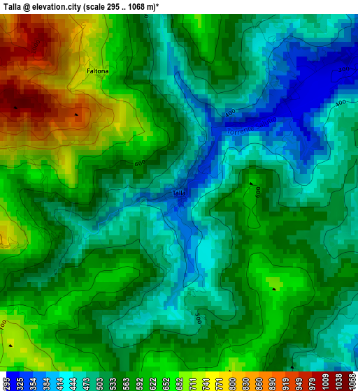
Below is the Elevation map of Talla, which displays elevation range with different colors. Scale of the first map is from 295 to 1068 m (968 to 3504 ft) with average elevation of 558.1 meters (=1831 ft) [note 1]
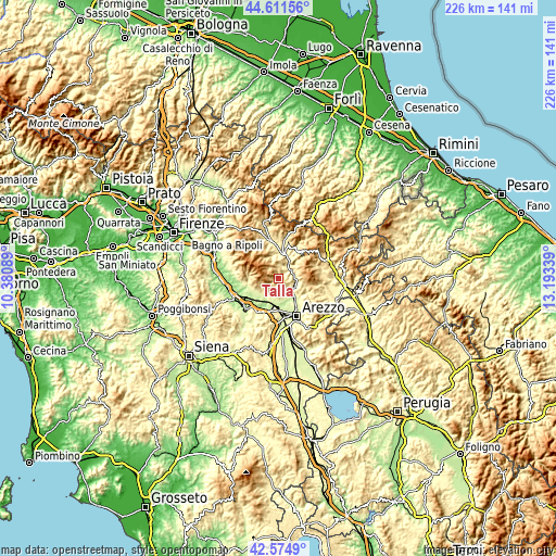
These maps also provides idea of topography and contour of this city, they are displayed at different zoom levels. More info about maps, scale and edge coordinates you can find below images.
| \ | Map #1 | Topo.Map |
| Scale [m] | 295..1068 m | × |
| Scale [ft] | 968..3504 ft | × |
| Average | 558.1 m = 1831 ft | × |
| Width | 7.08 km = 4.4 mi | 226.5 km = 140.7 mi |
| Height | 7.08 km = 4.4 mi | 226.4 km = 140.7 mi |
| ↑Max Latitude | 43.633665° | 44.61156° |
| Latitude at center | 43.60185° | 43.60185° |
| ↓Min Latitude | 43.570019° | 42.5749° |
| ← Min Longitude | 11.743195° | 10.38089° |
| Longitude center | 11.78714° | 11.78714° |
| →Max Longitude | 11.831085° | 13.19339° |
Nearby cities:
Cities around Talla sort by population:
• Bibbiena elevation 362 m
11 km,  11°
11°
• Subbiano 272 m
7.3 km,  111°
111°
• Loro Ciuffenna 310 m
12.8 km,  263°
263°
• Capolona 265 m
7.3 km,  122°
122°
• Rassina 313 m
6.4 km,  38°
38°
• Castiglion Fibocchi 276 m
8.5 km,  194°
194°
• Giovi-Ponte alla Chiassa 248 m
10.5 km,  143°
143°
• San Giustino Valdarno 299 m
8.6 km,  230°
230°
• Laterina 177 m
12.5 km,  206°
206°
• Quarata 248 m
11.9 km,  164°
164°
• Ortignano Raggiolo 425 m
9.2 km,  340°
340°
• Chitignano 578 m
10.1 km,  48°
48°
Multilingual:
 En español:
Talla elevación 356 m.
 En France:
Talla élévation 356 m.


Sources and notes:
- [note 1] Map square and city borders are not equal. Map elevation data is calculated only from area inside that square.
- [src 1] Elevation data from geonames database provided with same terms of usage.
- [src 2] The elevation map of Talla is generated using elevation data from NASA's 3 arcsec (90m) resolution SRTM data.
- [src 3] Base (background) map © OpenStreetMap contributors tiles are generated by Geofabrik and OpenTopoMap.
Copyright & License:
This Talla Elevation Map is licensed under CC BY-SA. You may reuse any part from this page, if you give a proper credit by linking to this URL:
 More info on terms of use page.