Turbigo elevation
Turbigo (Lombardy, Città metropolitana di Milano), Italy elevation is 149 meters and Turbigo elevation in feet is 489 ft above sea level [src 1]. Turbigo is a seat of a third-order administrative division (feature code) with elevation that is 173 meters (568 ft) smaller than average city elevation in Italy.
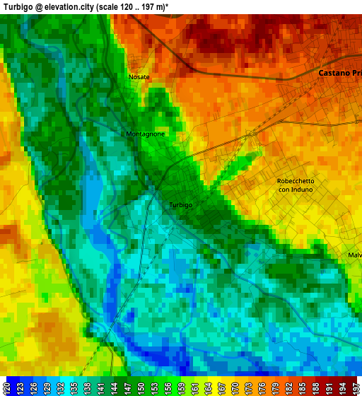
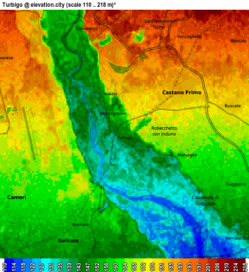
Below is the Elevation map of Turbigo, which displays elevation range with different colors. Scale of the first map is from 120 to 197 m (394 to 646 ft) with average elevation of 155.3 meters (=510 ft) [note 1]
These maps also provides idea of topography and contour of this city, they are displayed at different zoom levels. More info about maps, scale and edge coordinates you can find below images.
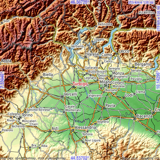
| \ | Map #1 | Map #2 | Topo.Map |
| Scale [m] | 120..197 m | 110..218 m | × |
| Scale [ft] | 394..646 ft | 361..715 ft | × |
| Average | 155.3 m = 510 ft | 164 m = 538 ft | × |
| Width | 6.85 km = 4.3 mi | 13.69 km = 8.5 mi | 219.1 km = 136.1 mi |
| Height | 6.85 km = 4.3 mi | 13.69 km = 8.5 mi | 219.1 km = 136.1 mi |
| ↑Max Latitude | 45.561536° | 45.592296° | 46.50725° |
| Latitude at center | 45.53076° | 45.53076° | 45.53076° |
| ↓Min Latitude | 45.499967° | 45.469157° | 44.53702° |
| ← Min Longitude | 8.692765° | 8.648819° | 7.33046° |
| Longitude center | 8.73671° | 8.73671° | 8.73671° |
| →Max Longitude | 8.780655° | 8.824601° | 10.14296° |
Nearby cities:
Cities around Turbigo sort by population:
• Galliate elevation 156 m
6.5 km,  207°
207°
• Lonate Pozzolo 203 m
6.9 km,  9°
9°
• Castano Primo 184 m
3.8 km,  52°
52°
• Cameri 169 m
6.6 km,  240°
240°
• Magnago 200 m
7.4 km,  43°
43°
• Cuggiono 158 m
6.7 km,  113°
113°
• Vanzaghello 197 m
6.5 km,  33°
33°
• Romentino 148 m
7.7 km,  190°
190°
• Buscate 179 m
6.1 km,  76°
76°
• Robecchetto Con Induno 168 m
2.7 km,  95°
95°
• Casate 149 m
8.3 km,  121°
121°
• Nosate 175 m
2.4 km,  337°
337°
Multilingual:
 En español:
Turbigo elevación 149 m.
 En France:
Turbigo élévation 149 m.


Sources and notes:
- [note 1] Map square and city borders are not equal. Map elevation data is calculated only from area inside that square.
- [src 1] Elevation data from geonames database provided with same terms of usage.
- [src 2] The elevation map of Turbigo is generated using elevation data from NASA's 3 arcsec (90m) resolution SRTM data.
- [src 3] Base (background) map © OpenStreetMap contributors tiles are generated by Geofabrik and OpenTopoMap.
Copyright & License:
This Turbigo Elevation Map is licensed under CC BY-SA. You may reuse any part from this page, if you give a proper credit by linking to this URL:
 More info on terms of use page.