Vinadio elevation
Vinadio (Piedmont, Provincia di Cuneo), Italy elevation is 889 meters and Vinadio elevation in feet is 2917 ft above sea level [src 1]. Vinadio is a seat of a third-order administrative division (feature code) with elevation that is 567 meters (1860 ft) bigger than average city elevation in Italy.
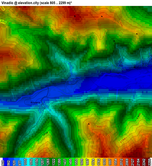
Below is the Elevation map of Vinadio, which displays elevation range with different colors. Scale of the first map is from 805 to 2299 m (2641 to 7543 ft) with average elevation of 1432.1 meters (=4698 ft) [note 1]
These maps also provides idea of topography and contour of this city, they are displayed at different zoom levels. More info about maps, scale and edge coordinates you can find below images.
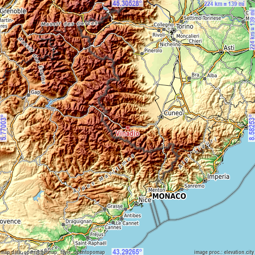
| \ | Map #1 | Topo.Map |
| Scale [m] | 805..2299 m | × |
| Scale [ft] | 2641..7543 ft | × |
| Average | 1432.1 m = 4698 ft | × |
| Width | 6.99 km = 4.3 mi | 223.8 km = 139.1 mi |
| Height | 6.99 km = 4.3 mi | 223.8 km = 139.1 mi |
| ↑Max Latitude | 44.339029° | 45.30528° |
| Latitude at center | 44.30759° | 44.30759° |
| ↓Min Latitude | 44.276134° | 43.29265° |
| ← Min Longitude | 7.132335° | 5.77003° |
| Longitude center | 7.17628° | 7.17628° |
| →Max Longitude | 7.220225° | 8.58253° |
Nearby cities:
Cities around Vinadio sort by population:
• Demonte elevation 769 m
9.7 km,  84°
84°
• Valdieri 786 m
17.9 km,  100°
100°
• Monterosso Grana 730 m
16.2 km,  46°
46°
• Pradleves 810 m
14.8 km,  34°
34°
• Aisone 854 m
3.5 km, 78°
• Moiola 691 m
17 km, 84°
• Valloriate 785 m
16.1 km, 78°
• Sambuco 1131 m
8.3 km,  291°
291°
• Pietraporzio 1225 m
12 km, 289°
• Canosio 1260 m
18.1 km,  335°
335°
• Marmora 1239 m
18 km, 338°
• Campomolino 1170 m
11.6 km,  14°
14°
Multilingual:
 En español:
Vinadio elevación 889 m.
 En France:
Vinadio élévation 889 m.


Sources and notes:
- [note 1] Map square and city borders are not equal. Map elevation data is calculated only from area inside that square.
- [src 1] Elevation data from geonames database provided with same terms of usage.
- [src 2] The elevation map of Vinadio is generated using elevation data from NASA's 3 arcsec (90m) resolution SRTM data.
- [src 3] Base (background) map © OpenStreetMap contributors tiles are generated by Geofabrik and OpenTopoMap.
Copyright & License:
This Vinadio Elevation Map is licensed under CC BY-SA. You may reuse any part from this page, if you give a proper credit by linking to this URL:
 More info on terms of use page.