Viticuso elevation
Viticuso (Latium, Provincia di Frosinone), Italy elevation is 858 meters and Viticuso elevation in feet is 2815 ft above sea level [src 1]. Viticuso is a seat of a third-order administrative division (feature code) with elevation that is 536 meters (1759 ft) bigger than average city elevation in Italy.
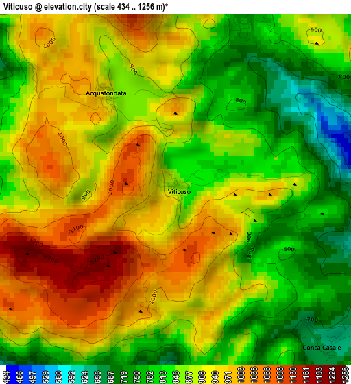
Below is the Elevation map of Viticuso, which displays elevation range with different colors. Scale of the first map is from 434 to 1256 m (1424 to 4121 ft) with average elevation of 889.8 meters (=2919 ft) [note 1]
These maps also provides idea of topography and contour of this city, they are displayed at different zoom levels. More info about maps, scale and edge coordinates you can find below images.
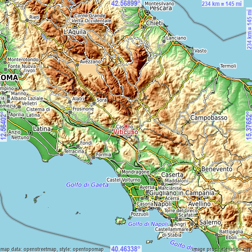
| \ | Map #1 | Topo.Map |
| Scale [m] | 434..1256 m | × |
| Scale [ft] | 1424..4121 ft | × |
| Average | 889.8 m = 2919 ft | × |
| Width | 7.32 km = 4.5 mi | 234.1 km = 145.5 mi |
| Height | 7.32 km = 4.5 mi | 234.1 km = 145.5 mi |
| ↑Max Latitude | 41.557642° | 42.56899° |
| Latitude at center | 41.52475° | 41.52475° |
| ↓Min Latitude | 41.491841° | 40.46338° |
| ← Min Longitude | 13.926325° | 12.56402° |
| Longitude center | 13.97027° | 13.97027° |
| →Max Longitude | 14.014215° | 15.37652° |
Nearby cities:
Cities around Viticuso sort by population:
• Venafro elevation 178 m
8 km,  125°
125°
• Sant'Elia Fiumerapido 128 m
9 km,  275°
275°
• Cervaro 239 m
7.3 km,  230°
230°
• San Bartolomeo 55 m
10.5 km,  243°
243°
• Pozzilli 239 m
7.8 km,  100°
100°
• San Vittore del Lazio 199 m
7.6 km,  203°
203°
• San Pietro Infine 130 m
8.8 km,  185°
185°
• Vallerotonda 588 m
5.6 km,  302°
302°
• Conca Casale 656 m
4.5 km,  137°
137°
• Acquafondata 914 m
2.5 km,  324°
324°
• Filignano 467 m
7.6 km,  72°
72°
• San Biagio Saracinisco 851 m
10.5 km,  340°
340°
Multilingual:
 En español:
Viticuso elevación 858 m.
 En France:
Viticuso élévation 858 m.
 Auf Deutsch:
Viticuso höhe über dem Meeresspiegel ist 858 m.

Sources and notes:
- [note 1] Map square and city borders are not equal. Map elevation data is calculated only from area inside that square.
- [src 1] Elevation data from geonames database provided with same terms of usage.
- [src 2] The elevation map of Viticuso is generated using elevation data from NASA's 3 arcsec (90m) resolution SRTM data.
- [src 3] Base (background) map © OpenStreetMap contributors tiles are generated by Geofabrik and OpenTopoMap.
Copyright & License:
This Viticuso Elevation Map is licensed under CC BY-SA. You may reuse any part from this page, if you give a proper credit by linking to this URL:
 More info on terms of use page.