Zolla elevation
Zolla (Friuli Venezia Giulia, Provincia di Trieste), Italy elevation is 364 meters and Zolla elevation in feet is 1194 ft above sea level [src 1]. Zolla is a seat of a third-order administrative division (feature code) with elevation that is 42 meters (138 ft) bigger than average city elevation in Italy.
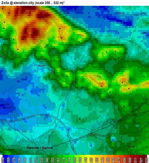
Below is the Elevation map of Zolla, which displays elevation range with different colors. Scale of the first map is from 258 to 532 m (846 to 1745 ft) with average elevation of 342 meters (=1122 ft) [note 1]
These maps also provides idea of topography and contour of this city, they are displayed at different zoom levels. More info about maps, scale and edge coordinates you can find below images.
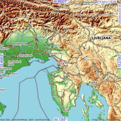
| \ | Map #1 | Topo.Map |
| Scale [m] | 258..532 m | × |
| Scale [ft] | 846..1745 ft | × |
| Average | 342 m = 1122 ft | × |
| Width | 6.82 km = 4.2 mi | 218.3 km = 135.6 mi |
| Height | 6.82 km = 4.2 mi | 218.3 km = 135.6 mi |
| ↑Max Latitude | 45.747654° | 46.69021° |
| Latitude at center | 45.71698° | 45.71698° |
| ↓Min Latitude | 45.686289° | 44.7265° |
| ← Min Longitude | 13.766435° | 12.40413° |
| Longitude center | 13.81038° | 13.81038° |
| →Max Longitude | 13.854325° | 15.21663° |
Nearby cities:
Cities around Zolla sort by population:
• Trieste elevation 19 m
7.9 km,  199°
199°
• Muggia 7 m
13 km,  194°
194°
• Villa Opicina 325 m
3.7 km,  207°
207°
• Sistiana-Visogliano 76 m
14.7 km,  294°
294°
• Aurisina 143 m
11.2 km, 288°
• Prosecco-Contovello 250 m
6 km,  260°
260°
• Dolina 109 m
13.5 km,  163°
163°
• Domio 18 m
11.9 km,  172°
172°
• Duino 41 m
17.2 km, 291°
• Santa Croce 207 m
9.3 km,  282°
282°
• Sgonico 273 m
5.3 km, 293°
• Aurisina Cave 132 m
12.4 km, 289°
Multilingual:
 En español:
Zolla elevación 364 m.
 En France:
Zolla élévation 364 m.


Sources and notes:
- [note 1] Map square and city borders are not equal. Map elevation data is calculated only from area inside that square.
- [src 1] Elevation data from geonames database provided with same terms of usage.
- [src 2] The elevation map of Zolla is generated using elevation data from NASA's 3 arcsec (90m) resolution SRTM data.
- [src 3] Base (background) map © OpenStreetMap contributors tiles are generated by Geofabrik and OpenTopoMap.
Copyright & License:
This Zolla Elevation Map is licensed under CC BY-SA. You may reuse any part from this page, if you give a proper credit by linking to this URL:
 More info on terms of use page.