Altofonte elevation
Altofonte (Sicily, Palermo), Italy elevation is 380 meters and Altofonte elevation in feet is 1247 ft above sea level [src 1]. Altofonte is a seat of a third-order administrative division (feature code) with elevation that is 58 meters (190 ft) bigger than average city elevation in Italy.
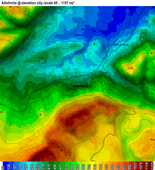
Below is the Elevation map of Altofonte, which displays elevation range with different colors. Scale of the first map is from 85 to 1157 m (279 to 3796 ft) with average elevation of 531.3 meters (=1743 ft) [note 1]
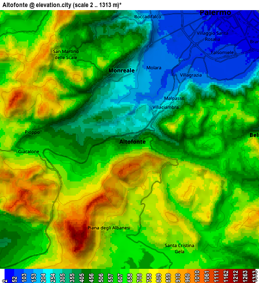
These maps also provides idea of topography and contour of this city, they are displayed at different zoom levels. More info about maps, scale and edge coordinates you can find below images.
| \ | Map #1 | Map #2 | Topo.Map |
| Scale [m] | 85..1157 m | 2..1313 m | × |
| Scale [ft] | 279..3796 ft | 7..4308 ft | × |
| Average | 531.3 m = 1743 ft | 563.5 m = 1849 ft | × |
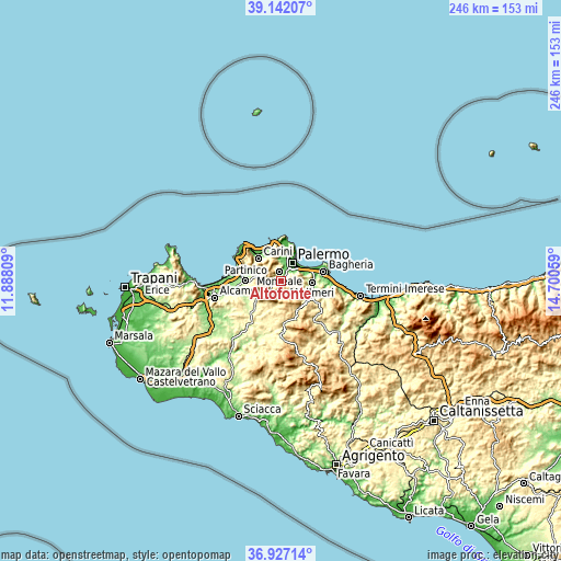
| Width | 7.7 km = 4.8 mi | 15.39 km = 9.6 mi | 246.3 km = 153 mi |
| Height | 7.7 km = 4.8 mi | 15.39 km = 9.6 mi | 246.3 km = 153 mi |
| ↑Max Latitude | 38.077581° | 38.112165° | 39.14207° |
| Latitude at center | 38.04298° | 38.04298° | 38.04298° |
| ↓Min Latitude | 38.008363° | 37.973729° | 36.92714° |
| ← Min Longitude | 13.250395° | 13.206449° | 11.88809° |
| Longitude center | 13.29434° | 13.29434° | 13.29434° |
| →Max Longitude | 13.338285° | 13.382231° | 14.70059° |
Nearby cities:
Cities around Altofonte sort by population:
• Palermo elevation 46 m
10.5 km,  20°
20°
• Monreale 314 m
4.3 km,  354°
354°
• Belmonte Mezzagno 349 m
8.6 km,  87°
87°
• Ciaculli 54 m
10.5 km,  70°
70°
• Piana degli Albanesi 642 m
5.5 km,  188°
188°
• Pioppo 508 m
5.4 km,  278°
278°
• Piano dei Geli 397 m
6.5 km,  344°
344°
• Piano Maglio-Blandino 208 m
2.1 km,  37°
37°
• Villa Ciambra 242 m
3 km,  47°
47°
• Cannizzaro-Favara 299 m
2.9 km,  316°
316°
• Giacalone 658 m
5.2 km,  257°
257°
• Santa Cristina Gela 679 m
7.1 km,  155°
155°
Multilingual:
 En español:
Altofonte elevación 380 m.
 En France:
Altofonte élévation 380 m.
 Auf Deutsch:
Altofonte höhe über dem Meeresspiegel ist 380 m.

Sources and notes:
- [note 1] Map square and city borders are not equal. Map elevation data is calculated only from area inside that square.
- [src 1] Elevation data from geonames database provided with same terms of usage.
- [src 2] The elevation map of Altofonte is generated using elevation data from NASA's 3 arcsec (90m) resolution SRTM data.
- [src 3] Base (background) map © OpenStreetMap contributors tiles are generated by Geofabrik and OpenTopoMap.
Copyright & License:
This Altofonte Elevation Map is licensed under CC BY-SA. You may reuse any part from this page, if you give a proper credit by linking to this URL:
 More info on terms of use page.