Avola elevation
Avola (Sicily, Provincia di Siracusa), Italy elevation is 34 meters and Avola elevation in feet is 112 ft above sea level [src 1]. Avola is a seat of a third-order administrative division (feature code) with elevation that is 288 meters (945 ft) smaller than average city elevation in Italy.
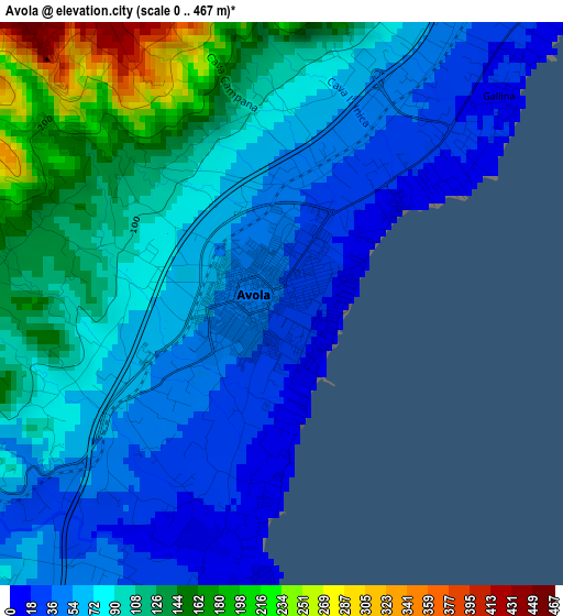
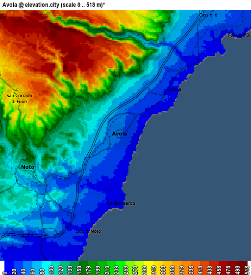
Below is the Elevation map of Avola, which displays elevation range with different colors. Scale of the first map is from 0 to 467 m (0 to 1532 ft) with average elevation of 87 meters (=285 ft) [note 1]
These maps also provides idea of topography and contour of this city, they are displayed at different zoom levels. More info about maps, scale and edge coordinates you can find below images.
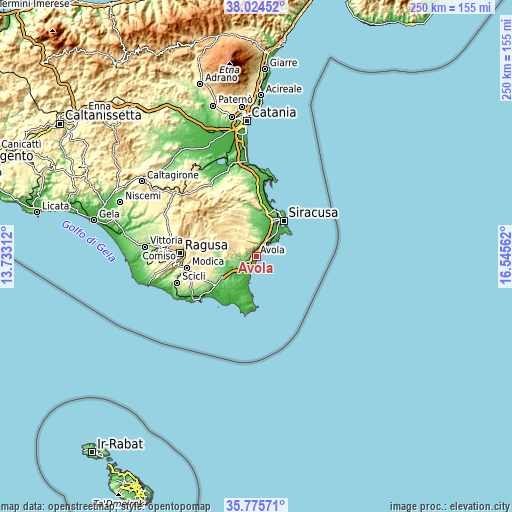
| \ | Map #1 | Map #2 | Topo.Map |
| Scale [m] | 0..467 m | 0..518 m | × |
| Scale [ft] | 0..1532 ft | 0..1699 ft | × |
| Average | 87 m = 285 ft | 172.6 m = 566 ft | × |
| Width | 7.81 km = 4.9 mi | 15.63 km = 9.7 mi | 250 km = 155.3 mi |
| Height | 7.81 km = 4.9 mi | 15.63 km = 9.7 mi | 250 km = 155.3 mi |
| ↑Max Latitude | 36.94353° | 36.978645° | 38.02452° |
| Latitude at center | 36.9084° | 36.9084° | 36.9084° |
| ↓Min Latitude | 36.873253° | 36.838091° | 35.77571° |
| ← Min Longitude | 15.095425° | 15.051479° | 13.73312° |
| Longitude center | 15.13937° | 15.13937° | 15.13937° |
| →Max Longitude | 15.183315° | 15.227261° | 16.54562° |
Nearby cities:
Cities around Avola sort by population:
• Siracusa elevation 22 m
22.7 km,  35°
35°
• Floridia 116 m
19.5 km,  3°
3°
• Pachino 70 m
21.9 km,  191°
191°
• Rosolini 145 m
19.3 km,  239°
239°
• Noto 138 m
6.4 km,  253°
253°
• Ispica 180 m
24.9 km, 236°
• Solarino 171 m
21.5 km,  355°
355°
• Canicattini Bagni 376 m
15.3 km,  333°
333°
• Belvedere 123 m
21.1 km,  18°
18°
• Cassibile 56 m
9.5 km,  34°
34°
• Città Giardino 90 m
22.7 km, 16°
• Carrozziere 12 m
18.6 km, 39°
Multilingual:
 En español:
Avola elevación 34 m.
 En France:
Avola élévation 34 m.


Sources and notes:
- [note 1] Map square and city borders are not equal. Map elevation data is calculated only from area inside that square.
- [src 1] Elevation data from geonames database provided with same terms of usage.
- [src 2] The elevation map of Avola is generated using elevation data from NASA's 3 arcsec (90m) resolution SRTM data.
- [src 3] Base (background) map © OpenStreetMap contributors tiles are generated by Geofabrik and OpenTopoMap.
Copyright & License:
This Avola Elevation Map is licensed under CC BY-SA. You may reuse any part from this page, if you give a proper credit by linking to this URL:
 More info on terms of use page.