Bianco elevation
Bianco (Calabria, Provincia di Reggio Calabria), Italy elevation is 10 meters and Bianco elevation in feet is 33 ft above sea level [src 1]. Bianco is a seat of a third-order administrative division (feature code) with elevation that is 312 meters (1024 ft) smaller than average city elevation in Italy.
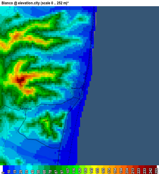
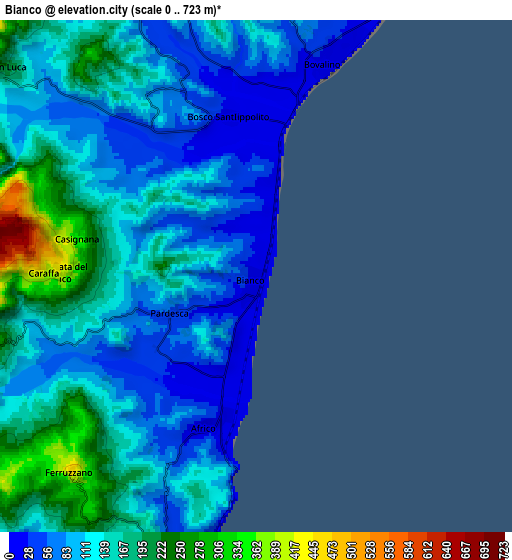
Below is the Elevation map of Bianco, which displays elevation range with different colors. Scale of the first map is from 0 to 252 m (0 to 827 ft) with average elevation of 57.1 meters (=187 ft) [note 1]
These maps also provides idea of topography and contour of this city, they are displayed at different zoom levels. More info about maps, scale and edge coordinates you can find below images.
| \ | Map #1 | Map #2 | Topo.Map |
| Scale [m] | 0..252 m | 0..723 m | × |
| Scale [ft] | 0..827 ft | 0..2372 ft | × |
| Average | 57.1 m = 187 ft | 128.2 m = 421 ft | × |
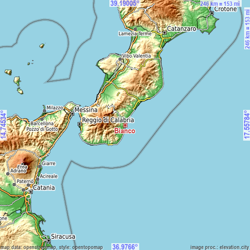
| Width | 7.69 km = 4.8 mi | 15.38 km = 9.6 mi | 246.1 km = 152.9 mi |
| Height | 7.69 km = 4.8 mi | 15.38 km = 9.6 mi | 246.1 km = 152.9 mi |
| ↑Max Latitude | 38.126278° | 38.160839° | 39.19005° |
| Latitude at center | 38.0917° | 38.0917° | 38.0917° |
| ↓Min Latitude | 38.057106° | 38.022495° | 36.9766° |
| ← Min Longitude | 16.107645° | 16.063699° | 14.74534° |
| Longitude center | 16.15159° | 16.15159° | 16.15159° |
| →Max Longitude | 16.195535° | 16.239481° | 17.55784° |
Nearby cities:
Cities around Bianco sort by population:
• Bovalino Superiore elevation 199 m
8.6 km,  4°
4°
• Bovalino 37 m
7.1 km,  14°
14°
• San Luca 195 m
9.7 km,  309°
309°
• Ardore Marina 1 m
9.3 km,  26°
26°
• Africo Nuovo 18 m
4.8 km,  199°
199°
• Samo 281 m
8.3 km,  256°
256°
• Benestare 293 m
10.4 km,  353°
353°
• Careri 333 m
10 km,  341°
341°
• Sant'Agata del Bianco 433 m
6 km,  270°
270°
• Casignana 344 m
5.5 km,  281°
281°
• Caraffa del Bianco 377 m
5.6 km, 271°
• Ferruzzano 398 m
8.2 km,  221°
221°
Multilingual:
 En español:
Bianco elevación 10 m.
 En France:
Bianco élévation 10 m.


Sources and notes:
- [note 1] Map square and city borders are not equal. Map elevation data is calculated only from area inside that square.
- [src 1] Elevation data from geonames database provided with same terms of usage.
- [src 2] The elevation map of Bianco is generated using elevation data from NASA's 3 arcsec (90m) resolution SRTM data.
- [src 3] Base (background) map © OpenStreetMap contributors tiles are generated by Geofabrik and OpenTopoMap.
Copyright & License:
This Bianco Elevation Map is licensed under CC BY-SA. You may reuse any part from this page, if you give a proper credit by linking to this URL:
 More info on terms of use page.