Spadafora elevation
Spadafora (Sicily, Messina), Italy elevation is 14 meters and Spadafora elevation in feet is 46 ft above sea level [src 1]. Spadafora is a seat of a third-order administrative division (feature code) with elevation that is 308 meters (1010 ft) smaller than average city elevation in Italy.
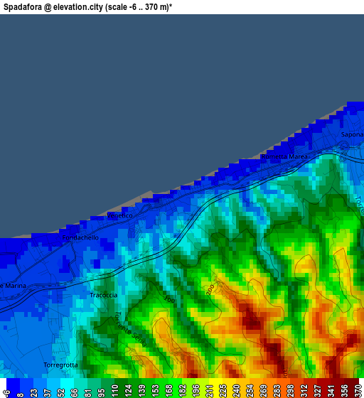
Below is the Elevation map of Spadafora, which displays elevation range with different colors. Scale of the first map is from -6 to 370 m (-20 to 1214 ft) with average elevation of 115.6 meters (=379 ft) [note 1]
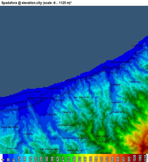
These maps also provides idea of topography and contour of this city, they are displayed at different zoom levels. More info about maps, scale and edge coordinates you can find below images.
| \ | Map #1 | Map #2 | Topo.Map |
| Scale [m] | -6..370 m | -6..1125 m | × |
| Scale [ft] | -20..1214 ft | -20..3691 ft | × |
| Average | 115.6 m = 379 ft | 209.2 m = 686 ft | × |
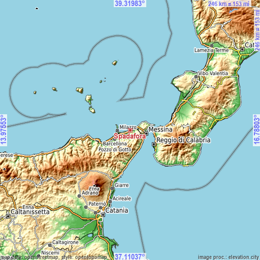
| Width | 7.68 km = 4.8 mi | 15.35 km = 9.5 mi | 245.7 km = 152.7 mi |
| Height | 7.68 km = 4.8 mi | 15.35 km = 9.5 mi | 245.7 km = 152.7 mi |
| ↑Max Latitude | 38.258005° | 38.292504° | 39.31983° |
| Latitude at center | 38.22349° | 38.22349° | 38.22349° |
| ↓Min Latitude | 38.188958° | 38.15441° | 37.11037° |
| ← Min Longitude | 15.337835° | 15.293889° | 13.97553° |
| Longitude center | 15.38178° | 15.38178° | 15.38178° |
| →Max Longitude | 15.425725° | 15.469671° | 16.78803° |
Nearby cities:
Cities around Spadafora sort by population:
• Villafranca Tirrena elevation 23 m
5.3 km,  70°
70°
• Torregrotta 26 m
3.6 km,  230°
230°
• Rometta Marea 12 m
2.6 km, 67°
• Venetico Marina 10 m
1.4 km,  250°
250°
• Giammoro 10 m
6.9 km, 251°
• Saponara Marittima 43 m
4 km,  77°
77°
• Saponara 163 m
5.8 km,  126°
126°
• Rometta 518 m
6.6 km,  154°
154°
• Roccavaldina 309 m
4.6 km,  188°
188°
• Condrò 83 m
7.3 km,  221°
221°
• Valdina 223 m
3.5 km,  197°
197°
• Venetico Superiore 283 m
3.4 km,  180°
180°
Multilingual:
 En español:
Spadafora elevación 14 m.
 En France:
Spadafora élévation 14 m.
 Auf Deutsch:
Spadafora höhe über dem Meeresspiegel ist 14 m.

Sources and notes:
- [note 1] Map square and city borders are not equal. Map elevation data is calculated only from area inside that square.
- [src 1] Elevation data from geonames database provided with same terms of usage.
- [src 2] The elevation map of Spadafora is generated using elevation data from NASA's 3 arcsec (90m) resolution SRTM data.
- [src 3] Base (background) map © OpenStreetMap contributors tiles are generated by Geofabrik and OpenTopoMap.
Copyright & License:
This Spadafora Elevation Map is licensed under CC BY-SA. You may reuse any part from this page, if you give a proper credit by linking to this URL:
 More info on terms of use page.