Tortora elevation
Tortora (Calabria, Provincia di Cosenza), Italy elevation is 292 meters and Tortora elevation in feet is 958 ft above sea level [src 1]. Tortora is a seat of a third-order administrative division (feature code) with elevation that is 30 meters (98 ft) smaller than average city elevation in Italy.
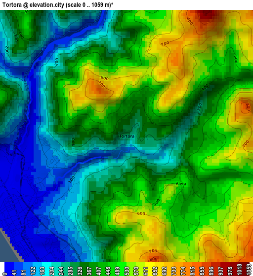
Below is the Elevation map of Tortora, which displays elevation range with different colors. Scale of the first map is from 0 to 1059 m (0 to 3474 ft) with average elevation of 383 meters (=1257 ft) [note 1]
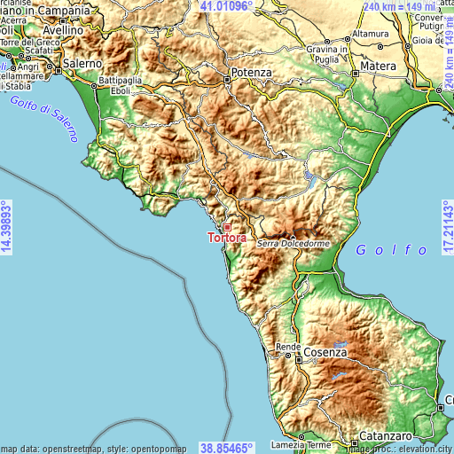
These maps also provides idea of topography and contour of this city, they are displayed at different zoom levels. More info about maps, scale and edge coordinates you can find below images.
| \ | Map #1 | Topo.Map |
| Scale [m] | 0..1059 m | × |
| Scale [ft] | 0..3474 ft | × |
| Average | 383 m = 1257 ft | × |
| Width | 7.49 km = 4.7 mi | 239.8 km = 149 mi |
| Height | 7.49 km = 4.7 mi | 239.8 km = 149 mi |
| ↑Max Latitude | 39.974985° | 41.01096° |
| Latitude at center | 39.9413° | 39.9413° |
| ↓Min Latitude | 39.907599° | 38.85465° |
| ← Min Longitude | 15.761235° | 14.39893° |
| Longitude center | 15.80518° | 15.80518° |
| →Max Longitude | 15.849125° | 17.21143° |
Nearby cities:
Cities around Tortora sort by population:
• Praia a Mare elevation 17 m
5.5 km,  198°
198°
• Tortora Marina 14 m
3.7 km,  236°
236°
• Lauria 481 m
12.1 km,  13°
13°
• Maratea 179 m
10 km,  310°
310°
• Trecchina 503 m
9.8 km,  345°
345°
• San Nicola Arcella 125 m
11 km,  188°
188°
• Santa Domenica Talao 220 m
14.2 km,  163°
163°
• Laino Borgo 277 m
14.4 km,  84°
84°
• Aieta 490 m
2.2 km,  133°
133°
• Nemoli 422 m
14.1 km,  358°
358°
• Papasidero 167 m
11.6 km, 132°
• Laino Castello-Nuovo Centro 539 m
14.6 km,  92°
92°
Multilingual:
 En español:
Tortora elevación 292 m.
 En France:
Tortora élévation 292 m.


Sources and notes:
- [note 1] Map square and city borders are not equal. Map elevation data is calculated only from area inside that square.
- [src 1] Elevation data from geonames database provided with same terms of usage.
- [src 2] The elevation map of Tortora is generated using elevation data from NASA's 3 arcsec (90m) resolution SRTM data.
- [src 3] Base (background) map © OpenStreetMap contributors tiles are generated by Geofabrik and OpenTopoMap.
Copyright & License:
This Tortora Elevation Map is licensed under CC BY-SA. You may reuse any part from this page, if you give a proper credit by linking to this URL:
 More info on terms of use page.