Dogonbadan elevation
Dogonbadan (Kohgiluyeh and Boyer-Ahmad), Iran elevation is 723 meters and Dogonbadan elevation in feet is 2372 ft above sea level [src 1]. Dogonbadan is a populated place (feature code) with elevation that is 321 meters (1053 ft) smaller than average city elevation in Iran.
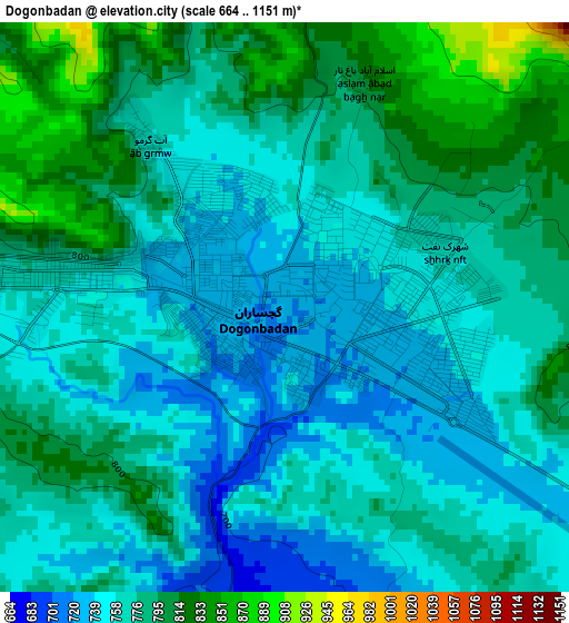
Below is the Elevation map of Dogonbadan, which displays elevation range with different colors. Scale of the first map is from 664 to 1151 m (2178 to 3776 ft) with average elevation of 774.1 meters (=2540 ft) [note 1]
These maps also provides idea of topography and contour of this city, they are displayed at different zoom levels. More info about maps, scale and edge coordinates you can find below images.
| \ | Map #1 | Map #2 | Topo.Map |
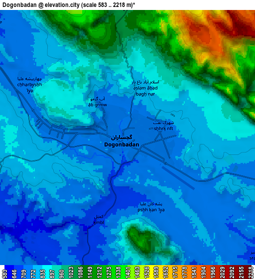
| Scale [m] | 664..1151 m | 583..2218 m | × |
| Scale [ft] | 2178..3776 ft | 1913..7277 ft | × |
| Average | 774.1 m = 2540 ft | 888.2 m = 2914 ft | × |
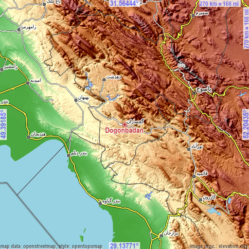
| Width | 8.43 km = 5.2 mi | 16.87 km = 10.5 mi | 269.8 km = 167.6 mi |
| Height | 8.43 km = 5.2 mi | 16.87 km = 10.5 mi | 269.8 km = 167.6 mi |
| ↑Max Latitude | 30.396512° | 30.43441° | 31.56444° |
| Latitude at center | 30.3586° | 30.3586° | 30.3586° |
| ↓Min Latitude | 30.320673° | 30.282732° | 29.13771° |
| ← Min Longitude | 50.754155° | 50.710209° | 49.39185° |
| Longitude center | 50.7981° | 50.7981° | 50.7981° |
| →Max Longitude | 50.842045° | 50.885991° | 52.20435° |
Nearby cities:
Cities around Dogonbadan sort by population:
• Yasuj elevation 1841 m
83.1 km,  65°
65°
• Behbahān 326 m
59.5 km,  296°
296°
• Dehdasht 806 m
53.4 km,  335°
335°
• Nūrābād 951 m
74.6 km,  111°
111°
• Bandar-e Genāveh 8 m
90.8 km,  197°
197°
• Aghajari 151 m
100.1 km,  292°
292°
• Hendījān 9 m
105.2 km,  262°
262°
• Līkak 652 m
90 km,  311°
311°
• Sīsakht 2267 m
84.4 km,  48°
48°
• Maşīrī 886 m
70.6 km,  100°
100°
• Bandar-e Deylam 5 m
70.1 km,  241°
241°
• Bāsht 807 m
34.5 km,  89°
89°
Multilingual:
 En español:
Dogonbadan elevación 723 m.
 En France:
Dogonbadan élévation 723 m.
 Auf Deutsch:
Dogonbadan höhe über dem Meeresspiegel ist 723 m.

Sources and notes:
- [note 1] Map square and city borders are not equal. Map elevation data is calculated only from area inside that square.
- [src 1] Elevation data from geonames database provided with same terms of usage.
- [src 2] The elevation map of Dogonbadan is generated using elevation data from NASA's 3 arcsec (90m) resolution SRTM data.
- [src 3] Base (background) map © OpenStreetMap contributors tiles are generated by Geofabrik and OpenTopoMap.
Copyright & License:
This Dogonbadan Elevation Map is licensed under CC BY-SA. You may reuse any part from this page, if you give a proper credit by linking to this URL:
 More info on terms of use page.