Nowshahr elevation
Nowshahr (Māzandarān), Iran elevation is -17 meters and Nowshahr elevation in feet is -56 ft above sea level [src 1]. Nowshahr is a seat of a second-order administrative division (feature code) with elevation that is 1061 meters (3481 ft) smaller than average city elevation in Iran.
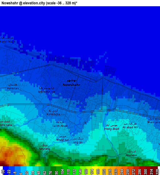
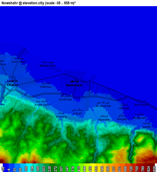
Below is the Elevation map of Nowshahr, which displays elevation range with different colors. Scale of the first map is from -36 to 328 m (-118 to 1076 ft) with average elevation of 4.1 meters (=13 ft) [note 1]
These maps also provides idea of topography and contour of this city, they are displayed at different zoom levels. More info about maps, scale and edge coordinates you can find below images.
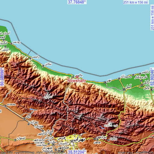
| \ | Map #1 | Map #2 | Topo.Map |
| Scale [m] | -36..328 m | -38..858 m | × |
| Scale [ft] | -118..1076 ft | -125..2815 ft | × |
| Average | 4.1 m = 13 ft | 78.9 m = 259 ft | × |
| Width | 7.84 km = 4.9 mi | 15.68 km = 9.7 mi | 250.9 km = 155.9 mi |
| Height | 7.84 km = 4.9 mi | 15.68 km = 9.7 mi | 250.9 km = 155.9 mi |
| ↑Max Latitude | 36.68377° | 36.719003° | 37.76848° |
| Latitude at center | 36.64852° | 36.64852° | 36.64852° |
| ↓Min Latitude | 36.613254° | 36.577972° | 35.51204° |
| ← Min Longitude | 51.452265° | 51.408319° | 50.08996° |
| Longitude center | 51.49621° | 51.49621° | 51.49621° |
| →Max Longitude | 51.540155° | 51.584101° | 52.90246° |
Nearby cities:
Cities around Nowshahr sort by population:
• Karaj elevation 1341 m
101.4 km,  206°
206°
• Āmol 96 m
78.9 km,  104°
104°
• Chālūs 26 m
6.8 km,  276°
276°
• Tonekābon -15 m
58.5 km,  288°
288°
• Fereydūnkenār -18 m
91.6 km,  87°
87°
• Nashtārūd -24 m
43.6 km, 285°
• Tajrīsh 1608 m
94.1 km,  183°
183°
• Shahrak 1823 m
83.7 km,  230°
230°
• Rāmsar 21 m
81.3 km, 291°
• Maḩmūdābād -23 m
68.4 km, 91°
• Nūr -18 m
47.1 km, 100°
• ‘Abbāsābād -19 m
35.9 km, 284°
Multilingual:
 En español:
Nowshahr elevación -17 m.
 En France:
Nowshahr élévation -17 m.
 Auf Deutsch:
Nowshahr höhe über dem Meeresspiegel ist -17 m.

Sources and notes:
- [note 1] Map square and city borders are not equal. Map elevation data is calculated only from area inside that square.
- [src 1] Elevation data from geonames database provided with same terms of usage.
- [src 2] The elevation map of Nowshahr is generated using elevation data from NASA's 3 arcsec (90m) resolution SRTM data.
- [src 3] Base (background) map © OpenStreetMap contributors tiles are generated by Geofabrik and OpenTopoMap.
Copyright & License:
This Nowshahr Elevation Map is licensed under CC BY-SA. You may reuse any part from this page, if you give a proper credit by linking to this URL:
 More info on terms of use page.