Sabzevar elevation
Sabzevar (Razavi Khorasan), Iran elevation is 974 meters and Sabzevar elevation in feet is 3196 ft above sea level [src 1]. Sabzevar is a populated place (feature code) with elevation that is 70 meters (230 ft) smaller than average city elevation in Iran.
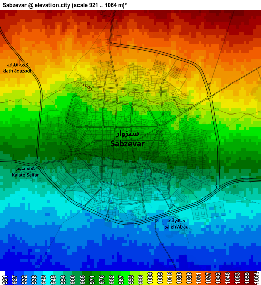
Below is the Elevation map of Sabzevar, which displays elevation range with different colors. Scale of the first map is from 921 to 1064 m (3022 to 3491 ft) with average elevation of 980.9 meters (=3218 ft) [note 1]
These maps also provides idea of topography and contour of this city, they are displayed at different zoom levels. More info about maps, scale and edge coordinates you can find below images.
| \ | Map #1 | Map #2 | Topo.Map |
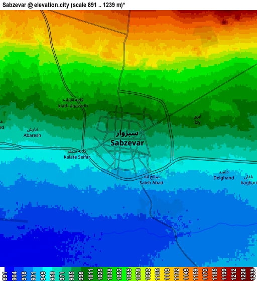
| Scale [m] | 921..1064 m | 891..1239 m | × |
| Scale [ft] | 3022..3491 ft | 2923..4065 ft | × |
| Average | 980.9 m = 3218 ft | 996.8 m = 3270 ft | × |
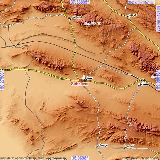
| Width | 7.88 km = 4.9 mi | 15.77 km = 9.8 mi | 252.3 km = 156.8 mi |
| Height | 7.88 km = 4.9 mi | 15.77 km = 9.8 mi | 252.3 km = 156.8 mi |
| ↑Max Latitude | 36.248048° | 36.283481° | 37.33895° |
| Latitude at center | 36.2126° | 36.2126° | 36.2126° |
| ↓Min Latitude | 36.177136° | 36.141655° | 35.0698° |
| ← Min Longitude | 57.637965° | 57.594019° | 56.27566° |
| Longitude center | 57.68191° | 57.68191° | 57.68191° |
| →Max Longitude | 57.725855° | 57.769801° | 59.08816° |
Nearby cities:
Cities around Sabzevar sort by population:
• Neyshābūr elevation 1199 m
99.9 km,  89°
89°
• Qūchān 1313 m
123.8 km,  36°
36°
• Kāshmar 1054 m
129.4 km,  146°
146°
• Shīrvān 1093 m
133.5 km,  9°
9°
• Esfarāyen 1253 m
97.3 km,  350°
350°
• Bardaskan 990 m
108.8 km,  166°
166°
• Fārūj 1183 m
123 km,  22°
22°
• Khalīlābād 980 m
119.7 km, 152°
• Bozghān 1168 m
81.5 km,  84°
84°
• Joghtāy 1360 m
72 km,  310°
310°
• Neqāb 1073 m
59.8 km,  337°
337°
• Solţānābād 1212 m
38.4 km,  56°
56°
Multilingual:
 En español:
Sabzevar elevación 974 m.
 En France:
Sabzevar élévation 974 m.
 Auf Deutsch:
Sabzevar höhe über dem Meeresspiegel ist 974 m.

Sources and notes:
- [note 1] Map square and city borders are not equal. Map elevation data is calculated only from area inside that square.
- [src 1] Elevation data from geonames database provided with same terms of usage.
- [src 2] The elevation map of Sabzevar is generated using elevation data from NASA's 3 arcsec (90m) resolution SRTM data.
- [src 3] Base (background) map © OpenStreetMap contributors tiles are generated by Geofabrik and OpenTopoMap.
Copyright & License:
This Sabzevar Elevation Map is licensed under CC BY-SA. You may reuse any part from this page, if you give a proper credit by linking to this URL:
 More info on terms of use page.