Shūshtar elevation
Shūshtar (Khuzestan), Iran elevation is 50 meters and Shūshtar elevation in feet is 164 ft above sea level [src 1]. Shūshtar is a seat of a second-order administrative division (feature code) with elevation that is 994 meters (3261 ft) smaller than average city elevation in Iran.
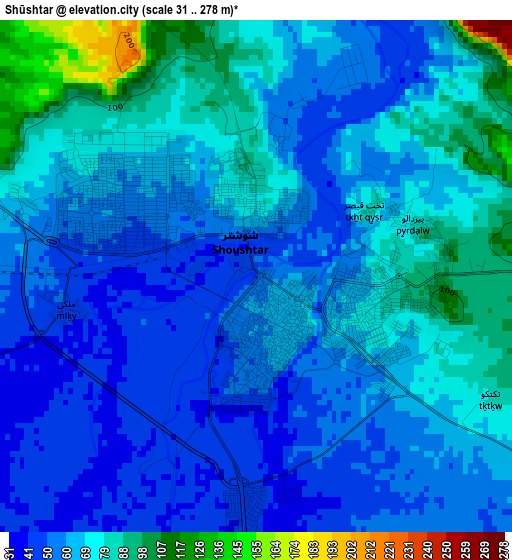
Below is the Elevation map of Shūshtar, which displays elevation range with different colors. Scale of the first map is from 31 to 278 m (102 to 912 ft) with average elevation of 65.3 meters (=214 ft) [note 1]
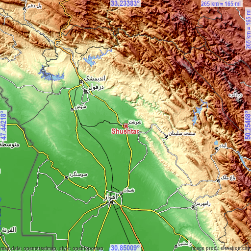
These maps also provides idea of topography and contour of this city, they are displayed at different zoom levels. More info about maps, scale and edge coordinates you can find below images.
| \ | Map #1 | Map #2 | Topo.Map |
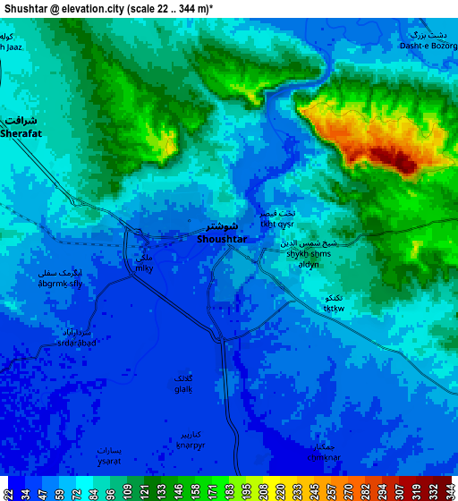
| Scale [m] | 31..278 m | 22..344 m | × |
| Scale [ft] | 102..912 ft | 72..1129 ft | × |
| Average | 65.3 m = 214 ft | 79.8 m = 262 ft | × |
| Width | 8.28 km = 5.1 mi | 16.57 km = 10.3 mi | 265 km = 164.7 mi |
| Height | 8.28 km = 5.1 mi | 16.57 km = 10.3 mi | 265.1 km = 164.7 mi |
| ↑Max Latitude | 32.08696° | 32.124185° | 33.23383° |
| Latitude at center | 32.04972° | 32.04972° | 32.04972° |
| ↓Min Latitude | 32.012465° | 31.975195° | 30.85009° |
| ← Min Longitude | 48.804485° | 48.760539° | 47.44218° |
| Longitude center | 48.84843° | 48.84843° | 48.84843° |
| →Max Longitude | 48.892375° | 48.936321° | 50.25468° |
Nearby cities:
Cities around Shūshtar sort by population:
• Ahvaz elevation 23 m
82.7 km,  190°
190°
• Masjed Soleymān 240 m
44.8 km,  106°
106°
• Shūsh 71 m
59.2 km,  285°
285°
• Sūsangerd 15 m
82.5 km,  229°
229°
• Jongīyeh 16 m
91 km, 193°
• Shahrak-e Kūlūrī 140 m
49 km,  313°
313°
• sedeyen-e Yek 21 m
76.5 km,  182°
182°
• Andīmeshk 147 m
65.3 km, 314°
• Qal‘eh-ye Khvājeh 753 m
58.8 km,  72°
72°
• Dezful 143 m
55.6 km, 311°
• Mollās̄ānī 28 m
51.8 km, 176°
• Dasht-e Lati 381 m
38.7 km,  36°
36°
Multilingual:
 En español:
Shūshtar elevación 50 m.
 En France:
Shūshtar élévation 50 m.


Sources and notes:
- [note 1] Map square and city borders are not equal. Map elevation data is calculated only from area inside that square.
- [src 1] Elevation data from geonames database provided with same terms of usage.
- [src 2] The elevation map of Shūshtar is generated using elevation data from NASA's 3 arcsec (90m) resolution SRTM data.
- [src 3] Base (background) map © OpenStreetMap contributors tiles are generated by Geofabrik and OpenTopoMap.
Copyright & License:
This Shūshtar Elevation Map is licensed under CC BY-SA. You may reuse any part from this page, if you give a proper credit by linking to this URL:
 More info on terms of use page.