‘Anat al Qadīmah elevation
‘Anat al Qadīmah (Anbar, Rawah District), Iraq elevation is 171 meters and ‘Anat al Qadīmah elevation in feet is 561 ft above sea level [src 1]. ‘Anat al Qadīmah is a destroyed populated place (feature code) with elevation that is 122 meters (400 ft) smaller than average city elevation in Iraq.
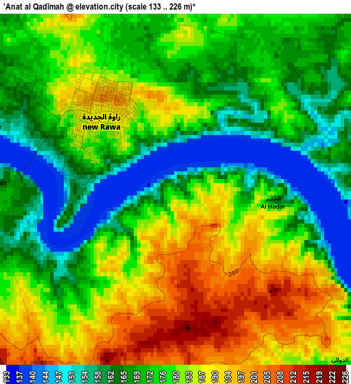
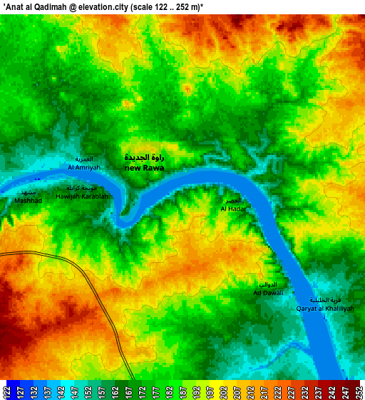
Below is the Elevation map of ‘Anat al Qadīmah, which displays elevation range with different colors. Scale of the first map is from 133 to 226 m (436 to 741 ft) with average elevation of 176.1 meters (=578 ft) [note 1]
These maps also provides idea of topography and contour of this city, they are displayed at different zoom levels. More info about maps, scale and edge coordinates you can find below images.
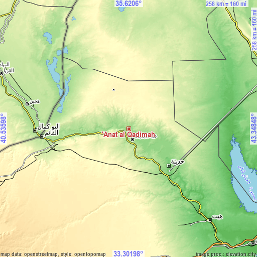
| \ | Map #1 | Map #2 | Topo.Map |
| Scale [m] | 133..226 m | 122..252 m | × |
| Scale [ft] | 436..741 ft | 400..827 ft | × |
| Average | 176.1 m = 578 ft | 183.2 m = 601 ft | × |
| Width | 8.06 km = 5 mi | 16.11 km = 10 mi | 257.8 km = 160.2 mi |
| Height | 8.06 km = 5 mi | 16.11 km = 10 mi | 257.8 km = 160.2 mi |
| ↑Max Latitude | 34.505562° | 34.541768° | 35.6206° |
| Latitude at center | 34.46934° | 34.46934° | 34.46934° |
| ↓Min Latitude | 34.433102° | 34.396849° | 33.30198° |
| ← Min Longitude | 41.898285° | 41.854339° | 40.53598° |
| Longitude center | 41.94223° | 41.94223° | 41.94223° |
| →Max Longitude | 41.986175° | 42.030121° | 43.34848° |
Nearby cities:
Cities around ‘Anat al Qadīmah sort by population:
• Tikrīt elevation 112 m
159.9 km,  84°
84°
• Bayjī 115 m
150.3 km,  70°
70°
• Hīt 61 m
123.4 km,  138°
138°
• Ḩadīthah 121 m
54.5 km,  132°
132°
• ‘Anah 177 m
11.8 km,  161°
161°
• Rāwah 186 m
2.6 km,  304°
304°
• Ad Dawr 93 m
169.7 km,  90°
90°
• Ash Sharqāt 159 m
165.2 km,  45°
45°
• Al ‘Awjah 77 m
164.3 km, 87°
• Al Ḩaḑar 207 m
142.3 km,  30°
30°
• Al Qā’im 180 m
87.8 km,  264°
264°
• Al Ḩaqlānīyah 126 m
57.5 km, 137°
Multilingual:
 En español:
‘Anat al Qadīmah elevación 171 m.
 En France:
‘Anat al Qadīmah élévation 171 m.
 Auf Deutsch:
‘Anat al Qadīmah höhe über dem Meeresspiegel ist 171 m.

Sources and notes:
- [note 1] Map square and city borders are not equal. Map elevation data is calculated only from area inside that square.
- [src 1] Elevation data from geonames database provided with same terms of usage.
- [src 2] The elevation map of ‘Anat al Qadīmah is generated using elevation data from NASA's 3 arcsec (90m) resolution SRTM data.
- [src 3] Base (background) map © OpenStreetMap contributors tiles are generated by Geofabrik and OpenTopoMap.
Copyright & License:
This ‘Anat al Qadīmah Elevation Map is licensed under CC BY-SA. You may reuse any part from this page, if you give a proper credit by linking to this URL:
 More info on terms of use page.