Najaf elevation
Najaf (An Najaf, Kufa), Iraq elevation is 41 meters and Najaf elevation in feet is 135 ft above sea level [src 1]. Najaf is a seat of a first-order administrative division (feature code) with elevation that is 252 meters (827 ft) smaller than average city elevation in Iraq.
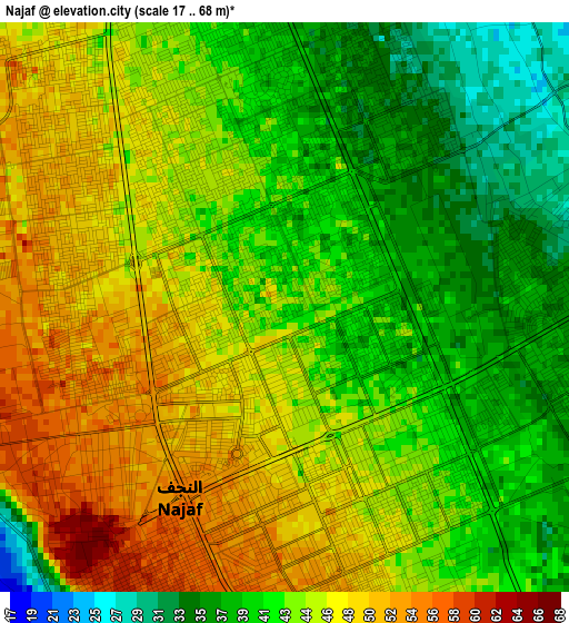
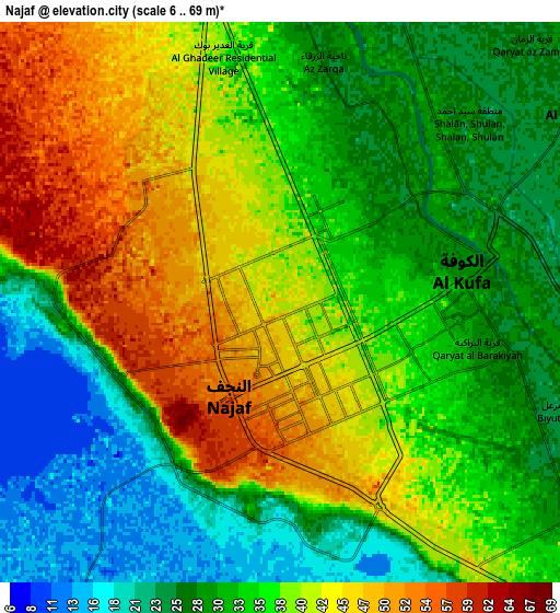
Below is the Elevation map of Najaf, which displays elevation range with different colors. Scale of the first map is from 17 to 68 m (56 to 223 ft) with average elevation of 43.9 meters (=144 ft) [note 1]
These maps also provides idea of topography and contour of this city, they are displayed at different zoom levels. More info about maps, scale and edge coordinates you can find below images.
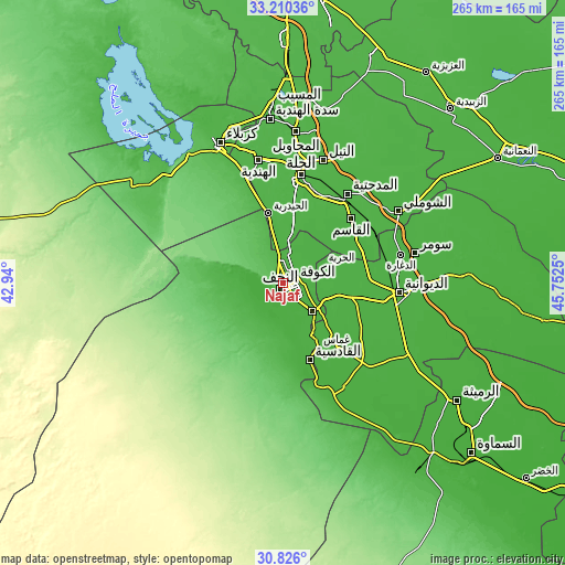
| \ | Map #1 | Map #2 | Topo.Map |
| Scale [m] | 17..68 m | 6..69 m | × |
| Scale [ft] | 56..223 ft | 20..226 ft | × |
| Average | 43.9 m = 144 ft | 35.2 m = 115 ft | × |
| Width | 8.29 km = 5.2 mi | 16.57 km = 10.3 mi | 265.1 km = 164.7 mi |
| Height | 8.29 km = 5.2 mi | 16.57 km = 10.3 mi | 265.1 km = 164.7 mi |
| ↑Max Latitude | 32.06319° | 32.100424° | 33.21036° |
| Latitude at center | 32.02594° | 32.02594° | 32.02594° |
| ↓Min Latitude | 31.988675° | 31.951395° | 30.826° |
| ← Min Longitude | 44.302305° | 44.258359° | 42.94° |
| Longitude center | 44.34625° | 44.34625° | 44.34625° |
| →Max Longitude | 44.390195° | 44.434141° | 45.7525° |
Nearby cities:
Cities around Najaf sort by population:
• Ad Dīwānīyah elevation 25 m
54.7 km,  93°
93°
• Al Ḩillah 33 m
49.2 km,  8°
8°
• Kufa 24 m
9.3 km,  72°
72°
• Ash Shāmīyah 23 m
25 km,  106°
106°
• Al Hindīyah 36 m
59 km,  349°
349°
• Imam Qasim 30 m
43.8 km,  46°
46°
• Nahiyat Ghammas 18 m
40.7 km,  140°
140°
• Al Mishkhāb 24 m
28.1 km,  151°
151°
• Nāḩiyat ash Shināfīyah 21 m
56.8 km, 149°
• Al Ḩamzah 23 m
68.3 km,  119°
119°
• Al Hāshimīyah 28 m
47.8 km,  38°
38°
• Al Manādhirah 27 m
18.7 km, 135°
Multilingual:
 En español:
Nayaf elevación 41 m.
 En France:
Nadjaf élévation 41 m.


Sources and notes:
- [note 1] Map square and city borders are not equal. Map elevation data is calculated only from area inside that square.
- [src 1] Elevation data from geonames database provided with same terms of usage.
- [src 2] The elevation map of Najaf is generated using elevation data from NASA's 3 arcsec (90m) resolution SRTM data.
- [src 3] Base (background) map © OpenStreetMap contributors tiles are generated by Geofabrik and OpenTopoMap.
Copyright & License:
This Najaf Elevation Map is licensed under CC BY-SA. You may reuse any part from this page, if you give a proper credit by linking to this URL:
 More info on terms of use page.