Koysinceq elevation
Koysinceq (Arbīl, Koisnjaq district), Iraq elevation is 600 meters and Koysinceq elevation in feet is 1969 ft above sea level [src 1]. Koysinceq is a seat of a second-order administrative division (feature code) with elevation that is 307 meters (1007 ft) bigger than average city elevation in Iraq.
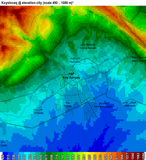
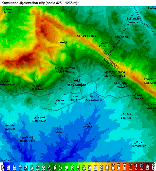
Below is the Elevation map of Koysinceq, which displays elevation range with different colors. Scale of the first map is from 490 to 1086 m (1608 to 3563 ft) with average elevation of 656.2 meters (=2153 ft) [note 1]
These maps also provides idea of topography and contour of this city, they are displayed at different zoom levels. More info about maps, scale and edge coordinates you can find below images.
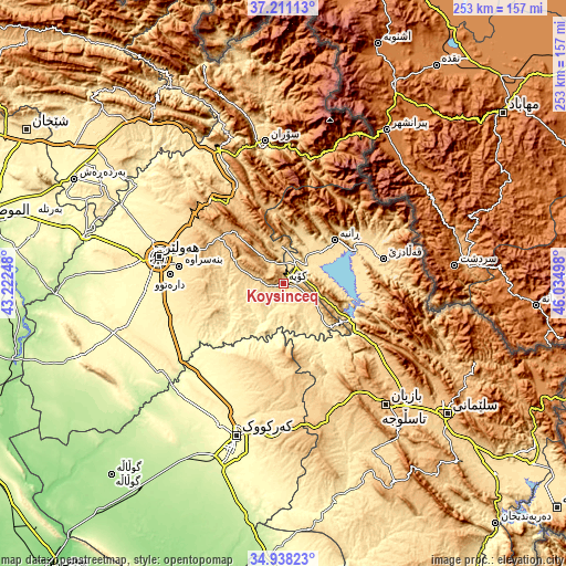
| \ | Map #1 | Map #2 | Topo.Map |
| Scale [m] | 490..1086 m | 425..1235 m | × |
| Scale [ft] | 1608..3563 ft | 1394..4052 ft | × |
| Average | 656.2 m = 2153 ft | 672.5 m = 2206 ft | × |
| Width | 7.9 km = 4.9 mi | 15.8 km = 9.8 mi | 252.7 km = 157 mi |
| Height | 7.9 km = 4.9 mi | 15.8 km = 9.8 mi | 252.7 km = 157 mi |
| ↑Max Latitude | 36.118397° | 36.153888° | 37.21113° |
| Latitude at center | 36.08289° | 36.08289° | 36.08289° |
| ↓Min Latitude | 36.047367° | 36.011828° | 34.93823° |
| ← Min Longitude | 44.584785° | 44.540839° | 43.22248° |
| Longitude center | 44.62873° | 44.62873° | 44.62873° |
| →Max Longitude | 44.672675° | 44.716621° | 46.03498° |
Nearby cities:
Cities around Koysinceq sort by population:
• Erbil elevation 428 m
56.5 km,  281°
281°
• Hayraw 1264 m
59 km,  85°
85°
• Halshaw 1064 m
58.3 km,  76°
76°
• Qushtepe 396 m
53.8 km,  260°
260°
• Dare Tû 439 m
51.3 km,  274°
274°
• Kasnazān 587 m
46.4 km,  286°
286°
• Qeładizê 601 m
46.4 km, 76°
• Shaqlāwah 913 m
44.9 km,  322°
322°
• Dukan 423 m
34.6 km,  119°
119°
• Ṟaniye 574 m
29.8 km,  49°
49°
• Nāḩiyat Hīrān 1036 m
25.2 km,  329°
329°
• Hīrān 906 m
24.8 km, 330°
Multilingual:
 En español:
Koysinceq elevación 600 m.
 En France:
Koysinceq élévation 600 m.
 Auf Deutsch:
Koysinceq höhe über dem Meeresspiegel ist 600 m.

Sources and notes:
- [note 1] Map square and city borders are not equal. Map elevation data is calculated only from area inside that square.
- [src 1] Elevation data from geonames database provided with same terms of usage.
- [src 2] The elevation map of Koysinceq is generated using elevation data from NASA's 3 arcsec (90m) resolution SRTM data.
- [src 3] Base (background) map © OpenStreetMap contributors tiles are generated by Geofabrik and OpenTopoMap.
Copyright & License:
This Koysinceq Elevation Map is licensed under CC BY-SA. You may reuse any part from this page, if you give a proper credit by linking to this URL:
 More info on terms of use page.