Tallkayf elevation
Tallkayf (Nineveh, Tel Keppe District), Iraq elevation is 279 meters and Tallkayf elevation in feet is 915 ft above sea level [src 1]. Tallkayf is a seat of a second-order administrative division (feature code) with elevation that is 14 meters (46 ft) smaller than average city elevation in Iraq.
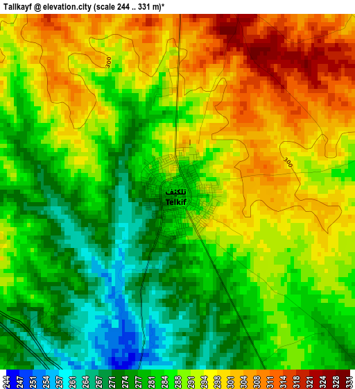
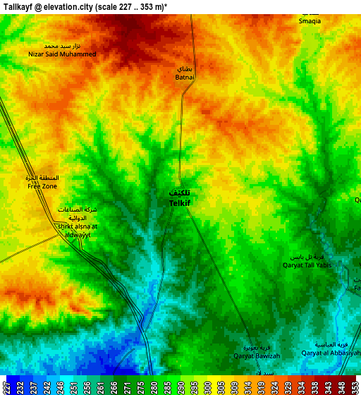
Below is the Elevation map of Tallkayf, which displays elevation range with different colors. Scale of the first map is from 244 to 331 m (801 to 1086 ft) with average elevation of 288.1 meters (=945 ft) [note 1]
These maps also provides idea of topography and contour of this city, they are displayed at different zoom levels. More info about maps, scale and edge coordinates you can find below images.
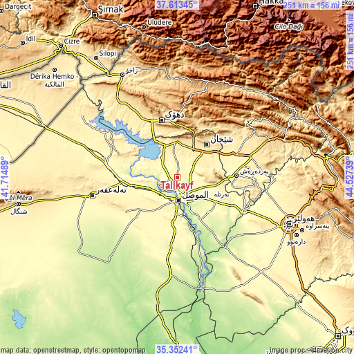
| \ | Map #1 | Map #2 | Topo.Map |
| Scale [m] | 244..331 m | 227..353 m | × |
| Scale [ft] | 801..1086 ft | 745..1158 ft | × |
| Average | 288.1 m = 945 ft | 289.8 m = 951 ft | × |
| Width | 7.86 km = 4.9 mi | 15.71 km = 9.8 mi | 251.4 km = 156.2 mi |
| Height | 7.86 km = 4.9 mi | 15.71 km = 9.8 mi | 251.4 km = 156.2 mi |
| ↑Max Latitude | 36.526502° | 36.561807° | 37.61345° |
| Latitude at center | 36.49118° | 36.49118° | 36.49118° |
| ↓Min Latitude | 36.455842° | 36.420488° | 35.35241° |
| ← Min Longitude | 43.077195° | 43.033249° | 41.71489° |
| Longitude center | 43.12114° | 43.12114° | 43.12114° |
| →Max Longitude | 43.165085° | 43.209031° | 44.52739° |
Nearby cities:
Cities around Tallkayf sort by population:
• Al Mawşil al Jadīdah elevation 239 m
17.7 km,  184°
184°
• Mosul 228 m
17.4 km, 180°
• Dihok 567 m
43.4 km,  344°
344°
• Sīnah 669 m
36 km,  348°
348°
• Al-Hamdaniya 274 m
33.6 km,  136°
136°
• Al ‘Amādīyah 1187 m
74.4 km,  26°
26°
• Bāmarnī 1280 m
71.4 km,  10°
10°
• Tall ‘Afar 407 m
61.5 km,  258°
258°
• Xebat 280 m
54.6 km,  115°
115°
• Saymayl 465 m
47.5 km,  329°
329°
• Zāwītah 848 m
46.1 km,  2°
2°
• Ash Shaykhān 512 m
30.7 km,  42°
42°
Multilingual:
 En español:
Tallkayf elevación 279 m.
 En France:
Tallkayf élévation 279 m.
 Auf Deutsch:
Tallkayf höhe über dem Meeresspiegel ist 279 m.

Sources and notes:
- [note 1] Map square and city borders are not equal. Map elevation data is calculated only from area inside that square.
- [src 1] Elevation data from geonames database provided with same terms of usage.
- [src 2] The elevation map of Tallkayf is generated using elevation data from NASA's 3 arcsec (90m) resolution SRTM data.
- [src 3] Base (background) map © OpenStreetMap contributors tiles are generated by Geofabrik and OpenTopoMap.
Copyright & License:
This Tallkayf Elevation Map is licensed under CC BY-SA. You may reuse any part from this page, if you give a proper credit by linking to this URL:
 More info on terms of use page.