Ghatkesar elevation
Ghatkesar (Telangana, Rangareddi), India elevation is 484 meters and Ghatkesar elevation in feet is 1588 ft above sea level [src 1]. Ghatkesar is a populated place (feature code) with elevation that is 191 meters (627 ft) bigger than average city elevation in India.
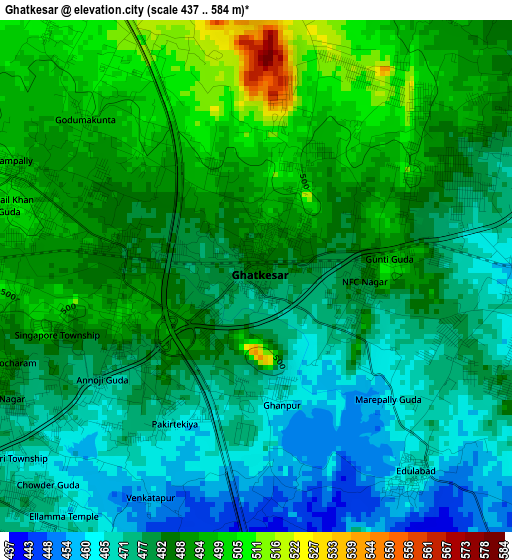
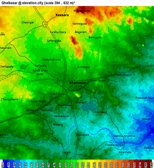
Below is the Elevation map of Ghatkesar, which displays elevation range with different colors. Scale of the first map is from 437 to 584 m (1434 to 1916 ft) with average elevation of 482.7 meters (=1584 ft) [note 1]
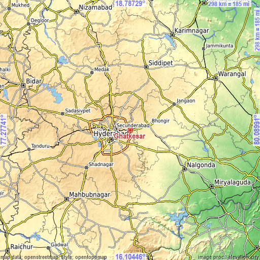
These maps also provides idea of topography and contour of this city, they are displayed at different zoom levels. More info about maps, scale and edge coordinates you can find below images.
| \ | Map #1 | Map #2 | Topo.Map |
| Scale [m] | 437..584 m | 394..632 m | × |
| Scale [ft] | 1434..1916 ft | 1293..2073 ft | × |
| Average | 482.7 m = 1584 ft | 485.8 m = 1594 ft | × |
| Width | 9.32 km = 5.8 mi | 18.65 km = 11.6 mi | 298.3 km = 185.4 mi |
| Height | 9.32 km = 5.8 mi | 18.65 km = 11.6 mi | 298.3 km = 185.4 mi |
| ↑Max Latitude | 17.492728° | 17.534636° | 18.78729° |
| Latitude at center | 17.45081° | 17.45081° | 17.45081° |
| ↓Min Latitude | 17.408882° | 17.366945° | 16.10446° |
| ← Min Longitude | 78.639715° | 78.595769° | 77.27741° |
| Longitude center | 78.68366° | 78.68366° | 78.68366° |
| →Max Longitude | 78.727605° | 78.771551° | 80.08991° |
Nearby cities:
Cities around Ghatkesar sort by population:
• Hyderabad elevation 515 m
25.2 km,  252°
252°
• Kūkatpalli 566 m
28.9 km,  277°
277°
• Lal Bahadur Nagar 511 m
17.6 km,  229°
229°
• Quthbullapur 554 m
24.6 km, 283°
• Secunderabad 566 m
16.1 km,  291°
291°
• Malkajgiri 536 m
16.7 km,  268°
268°
• Uppal Kalan 502 m
14.1 km, 249°
• Gaddi Annaram 492 m
19.3 km,  241°
241°
• Bhongīr 442 m
22.6 km,  71°
71°
• Bālāpur 543 m
25 km, 231°
• Gūdūr 440 m
15.5 km, 72°
• Medchal 591 m
29.3 km,  312°
312°
Multilingual:
 En español:
Ghatkesar elevación 484 m.
 En France:
Ghatkesar élévation 484 m.
 Auf Deutsch:
Ghatkesar höhe über dem Meeresspiegel ist 484 m.

Sources and notes:
- [note 1] Map square and city borders are not equal. Map elevation data is calculated only from area inside that square.
- [src 1] Elevation data from geonames database provided with same terms of usage.
- [src 2] The elevation map of Ghatkesar is generated using elevation data from NASA's 3 arcsec (90m) resolution SRTM data.
- [src 3] Base (background) map © OpenStreetMap contributors tiles are generated by Geofabrik and OpenTopoMap.
Copyright & License:
This Ghatkesar Elevation Map is licensed under CC BY-SA. You may reuse any part from this page, if you give a proper credit by linking to this URL:
 More info on terms of use page.