Serpur elevation
Serpur (West Bengal, South 24 Parganas), India elevation is 8 meters and Serpur elevation in feet is 26 ft above sea level [src 1]. Serpur is a populated place (feature code) with elevation that is 285 meters (935 ft) smaller than average city elevation in India.
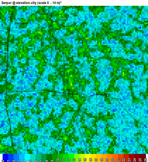
Below is the Elevation map of Serpur, which displays elevation range with different colors. Scale of the first map is from 0 to 14 m (0 to 46 ft) with average elevation of 6 meters (=20 ft) [note 1]
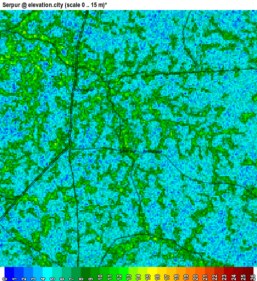
These maps also provides idea of topography and contour of this city, they are displayed at different zoom levels. More info about maps, scale and edge coordinates you can find below images.
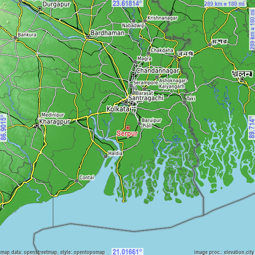
| \ | Map #1 | Map #2 | Topo.Map |
| Scale [m] | 0..14 m | 0..15 m | × |
| Scale [ft] | 0..46 ft | 0..49 ft | × |
| Average | 6 m = 20 ft | 5.8 m = 19 ft | × |
| Width | 9.04 km = 5.6 mi | 18.08 km = 11.2 mi | 289.3 km = 179.8 mi |
| Height | 9.04 km = 5.6 mi | 18.08 km = 11.2 mi | 289.3 km = 179.8 mi |
| ↑Max Latitude | 22.364086° | 22.40472° | 23.61814° |
| Latitude at center | 22.32344° | 22.32344° | 22.32344° |
| ↓Min Latitude | 22.282782° | 22.242113° | 21.01661° |
| ← Min Longitude | 88.263805° | 88.219859° | 86.9015° |
| Longitude center | 88.30775° | 88.30775° | 88.30775° |
| →Max Longitude | 88.351695° | 88.395641° | 89.714° |
Nearby cities:
Cities around Serpur sort by population:
• Bārāsat elevation 7 m
18.3 km,  126°
126°
• Baj Baj 9 m
21.5 km,  321°
321°
• Bāruipur 13 m
13.9 km,  76°
76°
• Diamond Harbour 9 m
19.3 km,  221°
221°
• Nabagrām 10 m
21.1 km,  100°
100°
• Jaynagar-Majilpur 10 m
19.9 km,  145°
145°
• Jāfarpur 7 m
8 km,  266°
266°
• Bāwāli 9 m
16.4 km,  314°
314°
• Chāmpāhāti 10 m
20.8 km,  65°
65°
• Amtala 8 m
6 km,  330°
330°
• Balarāmpur 9 m
1.6 km, 319°
• Bishnupur 9 m
7 km, 330°
Multilingual:
 En español:
Serpur elevación 8 m.
 En France:
Serpur élévation 8 m.


Sources and notes:
- [note 1] Map square and city borders are not equal. Map elevation data is calculated only from area inside that square.
- [src 1] Elevation data from geonames database provided with same terms of usage.
- [src 2] The elevation map of Serpur is generated using elevation data from NASA's 3 arcsec (90m) resolution SRTM data.
- [src 3] Base (background) map © OpenStreetMap contributors tiles are generated by Geofabrik and OpenTopoMap.
Copyright & License:
This Serpur Elevation Map is licensed under CC BY-SA. You may reuse any part from this page, if you give a proper credit by linking to this URL:
 More info on terms of use page.