Adalaj elevation
Adalaj (Gujarat, Gāndhīnagar), India elevation is 70 meters and Adalaj elevation in feet is 230 ft above sea level [src 1]. Adalaj is a populated place (feature code) with elevation that is 223 meters (732 ft) smaller than average city elevation in India.
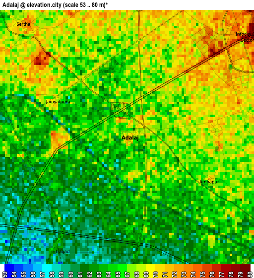
Below is the Elevation map of Adalaj, which displays elevation range with different colors. Scale of the first map is from 53 to 80 m (174 to 262 ft) with average elevation of 65.9 meters (=216 ft) [note 1]
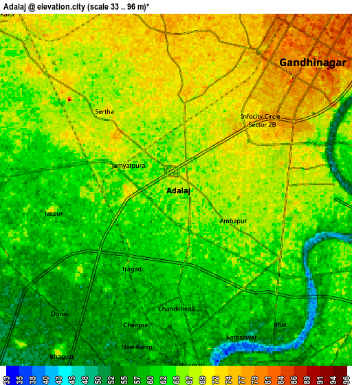
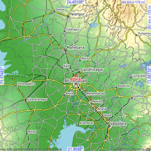
These maps also provides idea of topography and contour of this city, they are displayed at different zoom levels. More info about maps, scale and edge coordinates you can find below images.
| \ | Map #1 | Map #2 | Topo.Map |
| Scale [m] | 53..80 m | 33..96 m | × |
| Scale [ft] | 174..262 ft | 108..315 ft | × |
| Average | 65.9 m = 216 ft | 64.9 m = 213 ft | × |
| Width | 8.98 km = 5.6 mi | 17.97 km = 11.2 mi | 287.5 km = 178.6 mi |
| Height | 8.98 km = 5.6 mi | 17.97 km = 11.2 mi | 287.5 km = 178.6 mi |
| ↑Max Latitude | 23.204926° | 23.24531° | 24.45108° |
| Latitude at center | 23.16453° | 23.16453° | 23.16453° |
| ↓Min Latitude | 23.124122° | 23.083701° | 21.8655° |
| ← Min Longitude | 72.537125° | 72.493179° | 71.17482° |
| Longitude center | 72.58107° | 72.58107° | 72.58107° |
| →Max Longitude | 72.625015° | 72.668961° | 73.98732° |
Nearby cities:
Cities around Adalaj sort by population:
• Ahmedabad elevation 56 m
15.4 km,  177°
177°
• Gandhinagar 54 m
12 km,  60°
60°
• Kadi 66 m
29.4 km,  300°
300°
• Dahegām 79 m
24.6 km,  88°
88°
• Sānand 45 m
28 km,  226°
226°
• Mahemdāvād 37 m
41.9 km,  154°
154°
• Sarkhej 47 m
21.7 km,  201°
201°
• Mānsa 106 m
30.1 km,  15°
15°
• Kheda 38 m
47.1 km,  166°
166°
• Chhala 97 m
25.3 km,  51°
51°
• Jhulasan 77 m
21.3 km,  328°
328°
• Naroda 57 m
13 km,  143°
143°
Multilingual:
 En español:
Adalaj elevación 70 m.
 En France:
Adalaj élévation 70 m.


Sources and notes:
- [note 1] Map square and city borders are not equal. Map elevation data is calculated only from area inside that square.
- [src 1] Elevation data from geonames database provided with same terms of usage.
- [src 2] The elevation map of Adalaj is generated using elevation data from NASA's 3 arcsec (90m) resolution SRTM data.
- [src 3] Base (background) map © OpenStreetMap contributors tiles are generated by Geofabrik and OpenTopoMap.
Copyright & License:
This Adalaj Elevation Map is licensed under CC BY-SA. You may reuse any part from this page, if you give a proper credit by linking to this URL:
 More info on terms of use page.