Ajnāla elevation
Ajnāla (Punjab, Amritsar), India elevation is 231 meters and Ajnāla elevation in feet is 758 ft above sea level [src 1]. Ajnāla is a populated place (feature code) with elevation that is 62 meters (203 ft) smaller than average city elevation in India.
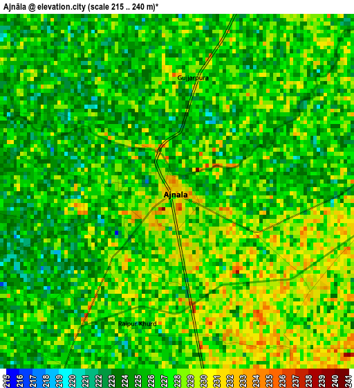
Below is the Elevation map of Ajnāla, which displays elevation range with different colors. Scale of the first map is from 215 to 240 m (705 to 787 ft) with average elevation of 226.4 meters (=743 ft) [note 1]
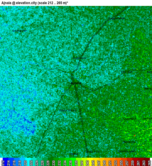
These maps also provides idea of topography and contour of this city, they are displayed at different zoom levels. More info about maps, scale and edge coordinates you can find below images.
| \ | Map #1 | Map #2 | Topo.Map |
| Scale [m] | 215..240 m | 212..265 m | × |
| Scale [ft] | 705..787 ft | 696..869 ft | × |
| Average | 226.4 m = 743 ft | 226.6 m = 743 ft | × |
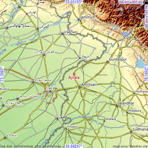
| Width | 8.3 km = 5.2 mi | 16.6 km = 10.3 mi | 265.6 km = 165 mi |
| Height | 8.3 km = 5.2 mi | 16.6 km = 10.3 mi | 265.6 km = 165 mi |
| ↑Max Latitude | 31.882053° | 31.919361° | 33.03153° |
| Latitude at center | 31.84473° | 31.84473° | 31.84473° |
| ↓Min Latitude | 31.807392° | 31.770038° | 30.64247° |
| ← Min Longitude | 74.719005° | 74.675059° | 73.3567° |
| Longitude center | 74.76295° | 74.76295° | 74.76295° |
| →Max Longitude | 74.806895° | 74.850841° | 76.1692° |
Nearby cities:
Cities around Ajnāla sort by population:
• Amritsar elevation 244 m
26.9 km,  156°
156°
• Batāla 258 m
41.8 km,  95°
95°
• Tarn Tāran 227 m
46.4 km, 160°
• Qādiān 254 m
58 km,  92°
92°
• Dhāriwāl 264 m
54.4 km,  76°
76°
• Fatehgarh Chūriān 242 m
18.4 km, 83°
• Majītha 241 m
20.9 km,  117°
117°
• Kalanaur 259 m
41.1 km,  63°
63°
• Rāja Sānsi 233 m
14.3 km,  165°
165°
• Jandiāla Gurū 238 m
40.2 km,  141°
141°
• Derā Nānak 240 m
32.9 km,  49°
49°
• Rām Dās 238 m
19.4 km, 45°
Multilingual:
 En español:
Ajnāla elevación 231 m.
 En France:
Ajnāla élévation 231 m.


Sources and notes:
- [note 1] Map square and city borders are not equal. Map elevation data is calculated only from area inside that square.
- [src 1] Elevation data from geonames database provided with same terms of usage.
- [src 2] The elevation map of Ajnāla is generated using elevation data from NASA's 3 arcsec (90m) resolution SRTM data.
- [src 3] Base (background) map © OpenStreetMap contributors tiles are generated by Geofabrik and OpenTopoMap.
Copyright & License:
This Ajnāla Elevation Map is licensed under CC BY-SA. You may reuse any part from this page, if you give a proper credit by linking to this URL:
 More info on terms of use page.