Alandur elevation
Alandur (Tamil Nadu, Kancheepuram), India elevation is 15 meters and Alandur elevation in feet is 49 ft above sea level [src 1]. Alandur is a section of populated place (feature code) with elevation that is 278 meters (912 ft) smaller than average city elevation in India.
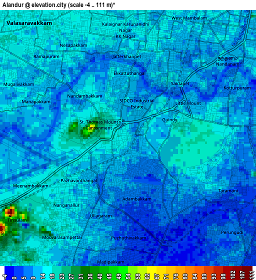
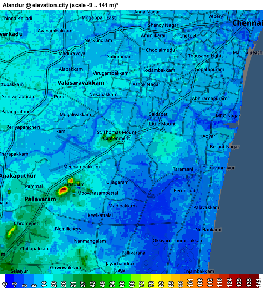
Below is the Elevation map of Alandur, which displays elevation range with different colors. Scale of the first map is from -4 to 111 m (-13 to 364 ft) with average elevation of 11.8 meters (=39 ft) [note 1]
These maps also provides idea of topography and contour of this city, they are displayed at different zoom levels. More info about maps, scale and edge coordinates you can find below images.
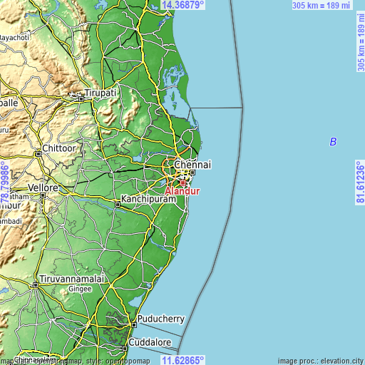
| \ | Map #1 | Map #2 | Topo.Map |
| Scale [m] | -4..111 m | -9..141 m | × |
| Scale [ft] | -13..364 ft | -30..463 ft | × |
| Average | 11.8 m = 39 ft | 12.7 m = 42 ft | × |
| Width | 9.52 km = 5.9 mi | 19.04 km = 11.8 mi | 304.7 km = 189.3 mi |
| Height | 9.52 km = 5.9 mi | 19.04 km = 11.8 mi | 304.7 km = 189.3 mi |
| ↑Max Latitude | 13.045315° | 13.088122° | 14.36879° |
| Latitude at center | 13.0025° | 13.0025° | 13.0025° |
| ↓Min Latitude | 12.959678° | 12.916848° | 11.62865° |
| ← Min Longitude | 80.162165° | 80.118219° | 78.79986° |
| Longitude center | 80.20611° | 80.20611° | 80.20611° |
| →Max Longitude | 80.250055° | 80.294001° | 81.61236° |
Nearby cities:
Cities around Alandur sort by population:
• Pallāvaram elevation 25 m
7.2 km,  237°
237°
• Poonamalle 21 m
11.1 km,  297°
297°
• Saint Thomas Mount 25 m
1.1 km,  274°
274°
• Porur 18 m
6.4 km,  305°
305°
• Perungudi 7 m
6 km,  140°
140°
• Injambakkam 8 m
10.7 km,  154°
154°
• Chetput 12 m
8.4 km,  26°
26°
• Madipakkam 6 m
4.5 km,  190°
190°
• Neelankarai 5 m
8.2 km, 135°
• Palavakkam 8 m
7.8 km,  134°
134°
• Gāndhī Nagar 10 m
5.2 km,  85°
85°
• Manappakkam 9 m
4.2 km,  282°
282°
Multilingual:
 En español:
Alandur elevación 15 m.
 En France:
Alandur élévation 15 m.


Sources and notes:
- [note 1] Map square and city borders are not equal. Map elevation data is calculated only from area inside that square.
- [src 1] Elevation data from geonames database provided with same terms of usage.
- [src 2] The elevation map of Alandur is generated using elevation data from NASA's 3 arcsec (90m) resolution SRTM data.
- [src 3] Base (background) map © OpenStreetMap contributors tiles are generated by Geofabrik and OpenTopoMap.
Copyright & License:
This Alandur Elevation Map is licensed under CC BY-SA. You may reuse any part from this page, if you give a proper credit by linking to this URL:
 More info on terms of use page.