Antri elevation
Antri (Madhya Pradesh, Gwalior), India elevation is 266 meters and Antri elevation in feet is 873 ft above sea level [src 1]. Antri is a populated place (feature code) with elevation that is 27 meters (89 ft) smaller than average city elevation in India.
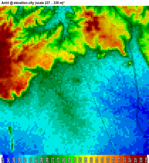
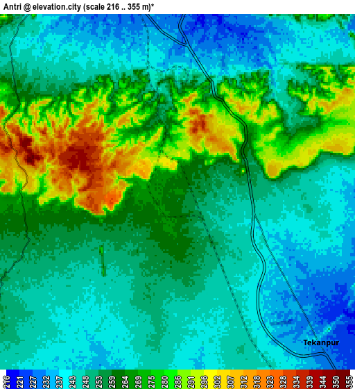
Below is the Elevation map of Antri, which displays elevation range with different colors. Scale of the first map is from 237 to 339 m (778 to 1112 ft) with average elevation of 271.5 meters (=891 ft) [note 1]
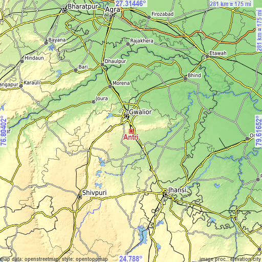
These maps also provides idea of topography and contour of this city, they are displayed at different zoom levels. More info about maps, scale and edge coordinates you can find below images.
| \ | Map #1 | Map #2 | Topo.Map |
| Scale [m] | 237..339 m | 216..355 m | × |
| Scale [ft] | 778..1112 ft | 709..1165 ft | × |
| Average | 271.5 m = 891 ft | 257.7 m = 845 ft | × |
| Width | 8.78 km = 5.5 mi | 17.56 km = 10.9 mi | 280.9 km = 174.5 mi |
| Height | 8.78 km = 5.5 mi | 17.56 km = 10.9 mi | 280.9 km = 174.5 mi |
| ↑Max Latitude | 26.097512° | 26.13697° | 27.31446° |
| Latitude at center | 26.05804° | 26.05804° | 26.05804° |
| ↓Min Latitude | 26.018555° | 25.979057° | 24.788° |
| ← Min Longitude | 78.166325° | 78.122379° | 76.80402° |
| Longitude center | 78.21027° | 78.21027° | 78.21027° |
| →Max Longitude | 78.254215° | 78.298161° | 79.61652° |
Nearby cities:
Cities around Antri sort by population:
• Gwalior elevation 220 m
19.5 km,  349°
349°
• Morena 181 m
53.5 km,  336°
336°
• Datia 247 m
49.5 km,  149°
149°
• Dabra 207 m
22.7 km, 147°
• Gohadi 158 m
47.6 km,  29°
29°
• Morār 207 m
18.8 km,  4°
4°
• Jora 191 m
51 km,  308°
308°
• Seondha 167 m
58 km,  79°
79°
• Mau 167 m
51.5 km,  63°
63°
• Bhitarwār 238 m
31.2 km,  198°
198°
• Narwar 286 m
54.8 km,  212°
212°
• Tekanpur 233 m
10.2 km,  134°
134°
Multilingual:
 En español:
Antri elevación 266 m.
 En France:
Antri élévation 266 m.


Sources and notes:
- [note 1] Map square and city borders are not equal. Map elevation data is calculated only from area inside that square.
- [src 1] Elevation data from geonames database provided with same terms of usage.
- [src 2] The elevation map of Antri is generated using elevation data from NASA's 3 arcsec (90m) resolution SRTM data.
- [src 3] Base (background) map © OpenStreetMap contributors tiles are generated by Geofabrik and OpenTopoMap.
Copyright & License:
This Antri Elevation Map is licensed under CC BY-SA. You may reuse any part from this page, if you give a proper credit by linking to this URL:
 More info on terms of use page.